Hesperus, Colorado | |
|---|---|
 Entering Hesperus from the south on
State Highway 140 | |
 Hesperus  Hesperus | |
| Coordinates: 37°17′12″N 108°02′21″W / 37.28667°N 108.03917°W | |
| Country | |
| State | |
| Counties | La Plata [1] |
| Elevation | 8,091 ft (2,466 m) |
| Time zone | UTC-7 ( MST) |
| • Summer ( DST) | UTC-6 ( MDT) |
| ZIP code [2] | 81326 |
| Area code | 970 |
Hesperus is an unincorporated community and a U.S. Post Office in La Plata County, Colorado, United States. The Hesperus Post Office has the ZIP Code 81326. [2]
A post office called Hesperus has been in operation since 1891. [3] The community takes its name from nearby Hesperus Mountain. [4]
Geography
Hesperus is located at 37°17′12″N 108°02′21″W / 37.28667°N 108.03917°W (37.286619,-108.039036).
Hesperus Baptist Church

See also
References
- ^ a b "US Board on Geographic Names". United States Geological Survey. October 25, 2007. Retrieved January 31, 2008.
- ^ a b "ZIP Code Lookup". United States Postal Service. December 28, 2006. Archived from the original ( JavaScript/ HTML) on November 22, 2010. Retrieved December 28, 2006.
- ^ "Post offices". Jim Forte Postal History. Retrieved June 27, 2016.
- ^ Dawson, John Frank. Place names in Colorado: why 700 communities were so named, 150 of Spanish or Indian origin. Denver, CO: The J. Frank Dawson Publishing Co. p. 26.
External links
![]() Media related to
Hesperus, Colorado at Wikimedia Commons
Media related to
Hesperus, Colorado at Wikimedia Commons
Municipalities and communities of
La Plata County, Colorado, United States | ||
|---|---|---|
| City | 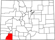 | |
| Towns | ||
| CDPs | ||
|
Unincorporated communities | ||
| Ghost towns | ||
|
Indian reservations | ||
| Footnotes | ‡This populated place also has portions in an adjacent county or counties | |
| International | |
|---|---|
| National | |
|
| This Colorado state location article is a stub. You can help Wikipedia by expanding it. |