Lille | |
|---|---|
 | |
| Coordinates: 51°14′N 04°50′E / 51.233°N 4.833°E | |
| Country | |
| Community | Flemish Community |
| Region | Flemish Region |
| Province | Antwerp |
| Arrondissement | Turnhout |
| Government | |
| • Mayor | Marleen Peeters ( N-VA) [1] |
| • Governing party/ies | N-VA, Groen |
| Area | |
| • Total | 59.62 km2 (23.02 sq mi) |
| Population (2020-01-01)
[2] | |
| • Total | 16,564 |
| • Density | 280/km2 (720/sq mi) |
| Postal codes | 2275 |
| NIS code | 13019 |
| Area codes | 014, 03 |
| Website | www.lille.be |
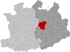
Lille (Dutch pronunciation: [ˈlɪlə]) is a municipality located in the Belgian Antwerp Province. The municipality comprises the towns of Lille, Gierle, Poederlee, and Wechelderzande. In 2021, Lille had a total population of 16,517. [3] The total area is 59.40 km².
The Krawatencross is an annual cyclo-cross race held in Lille every February.
Notable inhabitants
- Frans Van Giel, painter (1892–1975)
- Lords of Poederlée
References
- ^ "College van burgemeester en schepenen".
- ^ "Bevolking per gemeente op 1 januari 2020". Statbel.
- ^ "Bevolking per statistische sector – Sector 13019". Statistics Belgium. Retrieved 10 May 2022.
External links
-
 Media related to
Lille, Belgium at Wikimedia Commons
 - Official website – Available only in Dutch


