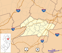
John De Camp House | |
 | |
| Location | 2101 Raritan Road, Scotch Plains, New Jersey |
|---|---|
| Coordinates | 40°37′38″N 74°20′27″W / 40.62722°N 74.34083°W |
| Area | 3.3 acres (1.3 ha) |
| Built | 1739 |
| Architect | DeCamp, John |
| Architectural style | Colonial |
| NRHP reference No. | 73001136 [1] |
| NJRHP No. | 2720 [2] |
| Significant dates | |
| Added to NRHP | December 4, 1973 |
| Designated NJRHP | September 14, 1973 |
The John De Camp House is located in Scotch Plains, Union County, New Jersey, United States. The house was built in 1739 and was added to the National Register of Historic Places on December 4, 1973.
See also
References
- ^ "National Register Information System". National Register of Historic Places. National Park Service. March 13, 2009.
- ^ "New Jersey and National Registers of Historic Places - Union County" (PDF). New Jersey Department of Environmental Protection - Historic Preservation Office. July 7, 2009. p. 19. Archived from the original (PDF) on April 7, 2009. Retrieved May 13, 2010.
Categories:
- Houses on the National Register of Historic Places in New Jersey
- Houses completed in 1739
- Houses in Union County, New Jersey
- National Register of Historic Places in Union County, New Jersey
- Scotch Plains, New Jersey
- New Jersey Register of Historic Places
- 1739 establishments in New Jersey
- New Jersey Registered Historic Place stubs


