Ituzaingó | |
|---|---|
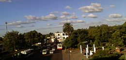
 City Hall and downtown promenade | |
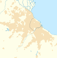
Location in
Greater Buenos Aires | |
| Coordinates: 34°40′S 58°40′W / 34.667°S 58.667°W | |
| Country | |
| Province |
|
| Partido | Ituzaingó |
| Elevation | 28 m (92 ft) |
| Population (2010 census) | |
| • Total | 168,419 |
| CPA Base |
B 1714 |
| Area code | + 54 11 |
| Website | Municipality of Ituzaingó |
Ituzaingó (Spanish pronunciation: [itusajŋˈɡo]) is the capital of the Ituzaingó Partido in the Greater Buenos Aires metropolitan area, Argentina, west of Buenos Aires.
Overview
Ituzaingó has been the capital of the Ituzaingó Partido or municipality of Buenos Aires Province since 1995, when the partido was created. Buildings of more than three stories were until recently prohibited and most houses are only one story high
The shopping area near the train station connecting the city with Buenos Aires City (Downtown) is located surrounding a square, opposite the church, where concerts, cultural events and fares are held on weekends and holidays.
Ituzaingó is 28 km (17 mi) away from the city of Buenos Aires. It has 38.51 km2 (14.87 sq mi) French-style chalets, quiet streets and leafy trees, which coexist in all neighborhoods of the city. According to the last national census of 2010, the population was of 168,419 people.
It stands out the neighborhood of Parque Leloir, one of the largest protected ecological zones of the Province, and also known to be a quiet residential neighborhood with huge houses and home of many celebrities.
Sport
Club Atlético Ituzaingó is the local professional team.
Notable people
- Ceferino Denis (born 1978), footballer
- Tomás Lanzini (born 1988), footballer
- Ricardo Passano (1922-2012), actor
- Nicolás Peranic (born 1985), footballer
- Fernando Caldeiro (1958-2009), Argentine-American NASA astronaut
- Moria Casán (born 1946), actress, producer, TV and theater personality
- Raúl Perrone (born 1952), filmmaker, cartoonist
References
- Municipality of Ituzaingó
- Municipal information: Municipal Affairs Federal Institute (IFAM), Municipal Affairs Secretariat, Ministry of Interior, Argentina. (in Spanish)
- La Voz De Ituzaingó - Local newspaper.
- (in English) The Battle of Ituzaingó - History of the battle from which the city takes its name.


