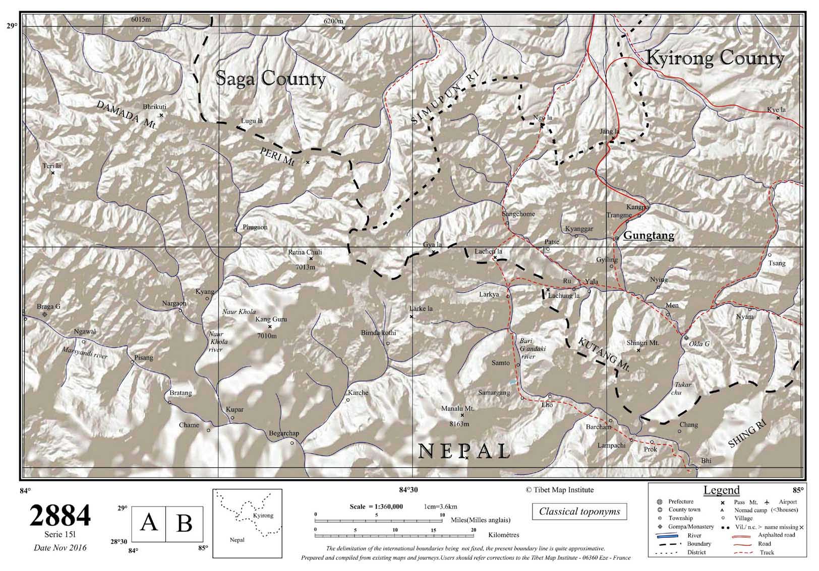
Gungtang, [1] [2] [a] or Kotang, [b] called Gongdang by China, [c] [5] is a village and township in the Gyirong County in the Shigatse Prefecture, Tibet region of China.
In addition to Gungtang, the township contains three villages: Ru, Tsang (Zhang village) and Kangpo (Kangbei village). [6]
See also
Notes
References
- ^ Roberts, Peter Alan (2000), The Biographies of Ras-chung-pa: The Evolution of a Tibetan Hagiography, University of Oxford, p. 165
- ^ Tibetmap sheet 2884, Tibet Map Institute, November 2016; Gungtang, KMAPS, University of Virginia, retrieved 14 January 2023.
- ^ a b c "Geographical names of Tibet AR (China): Xigazê Prefecture-Level City". KNAB Place Name Database. Institute of the Estonian Language. 2018-06-03.
- ^ Strachey, Henry (1854), Physical Geography of Western Tibet, London: William Clows and Sons, p. 4 – via archive.org
- ^ Townships of Jilong County, Nationanl Bureau of Stistics, China, retrieved 14 January 2023.
- ^ Gongdang Township, Nationanl Bureau of Stistics, China, retrieved 14 January 2023.
28°49′N 84°48′E / 28.817°N 84.800°E
|
| This Tibet location article is a stub. You can help Wikipedia by expanding it. |