Gegharkunik
Գեղարքունիք | |
|---|---|
 Saint Gevorg Church in Gegharkunik | |
 Gegharkunik  Gegharkunik | |
| Coordinates: 40°15′04″N 45°08′53″E / 40.25111°N 45.14806°E | |
| Country | Armenia |
| Province | Gegharkunik |
| Municipality | Gavar |
| Founded | 1828 |
| Elevation | 2,096 m (6,877 ft) |
| Population | |
| • Total | 1,654 |
| Time zone | UTC+4 ( AMT) |
| Postal code | 1207 |
| Gegharkunik (village) at GEOnet Names Server | |
Gegharkunik ( Armenian: Գեղարքունիք) is a Gavar Municipality of the village in the Gegharkunik Province of Armenia.
Etymology
The village was known as Bashkend until 1946.
History
The village was founded in 1828 by emigrants primarily from Gavar. The village contains a small church, and St. Gevorg Church on a hill nearby. [2]
Gallery
-
 WWII monument
 -
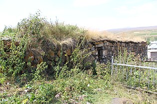
 St. George Chapel
 -
 Saint Gevorg Church
 -
 Khachkars around St. George Chapel


References
- ^ Statistical Committee of Armenia. "The results of the 2011 Population Census of Armenia" (PDF).
- ^ Kiesling, Brady; Kojian, Raffi (2005). Rediscovering Armenia: Guide (2nd ed.). Yerevan: Matit Graphic Design Studio. p. 78. ISBN 99941-0-121-8.
External links
Wikimedia Commons has media related to
Cultural heritage monuments in Gegharkunik, Gegharkunik.
- World Gazeteer: Armenia[ dead link] – World-Gazetteer.com
- Report of the results of the 2001 Armenian Census, Statistical Committee of Armenia
- Kiesling, Brady (June 2000). Rediscovering Armenia: An Archaeological/Touristic Gazetteer and Map Set for the Historical Monuments of Armenia (PDF). Archived (PDF) from the original on 6 November 2021.

|
| This article about a location in Gegharkunik Province, Armenia is a stub. You can help Wikipedia by expanding it. |