Fosters, Alabama | |
|---|---|
 Fosters, Alabama  Fosters, Alabama | |
| Coordinates: 33°05′41″N 87°41′09″W / 33.09472°N 87.68583°W | |
| Country | United States |
| State | Alabama |
| County | Tuscaloosa |
| Elevation | 151 ft (46 m) |
| Time zone | UTC-6 ( Central (CST)) |
| • Summer ( DST) | UTC-5 (CDT) |
| ZIP code | 35463 |
| Area code(s) | 205, 659 |
| GNIS feature ID | 156372 [1] |
Fosters is an unincorporated community in Tuscaloosa County, Alabama, United States. Fosters is located along U.S. Route 11 and U.S. Route 43, 10.4 miles (16.7 km) southwest of Tuscaloosa. Fosters has a post office with ZIP code 35463. [2] [3] Fosters is named in honor of the family of James Foster, who settled in the area in 1818. [4]
References
- ^ "Fosters". Geographic Names Information System. United States Geological Survey, United States Department of the Interior.
- ^ United States Postal Service (2012). "USPS - Look Up a ZIP Code". Retrieved February 15, 2012.
- ^ "Postmaster Finder - Post Offices by ZIP Code". United States Postal Service. Archived from the original on October 17, 2020. Retrieved June 5, 2013.
- ^ Foscue, Virginia (1989). Place Names in Alabama. Tuscaloosa: The University of Alabama Press. p. 59. ISBN 0-8173-0410-X.
Municipalities and communities of
Tuscaloosa County, Alabama, United States | ||
|---|---|---|
| Cities | 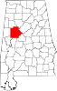 | |
| Towns | ||
| CDPs | ||
|
Other unincorporated communities | ||
| Ghost town | ||
| Footnotes | ‡This populated place also has portions in an adjacent county or counties | |
|
| This Tuscaloosa County, Alabama state location article is a stub. You can help Wikipedia by expanding it. |