
Size of this preview:
707 × 600 pixels. Other resolutions:
283 × 240 pixels |
566 × 480 pixels |
906 × 768 pixels |
1,207 × 1,024 pixels |
2,415 × 2,048 pixels |
8,866 × 7,520 pixels.
Original file (8,866 × 7,520 pixels, file size: 8.11 MB, MIME type: image/jpeg)
| This is a file from the
Wikimedia Commons. Information from its
description page there is shown below. Commons is a freely licensed media file repository. You can help. |
| Warning | The original file is very high-resolution. It might not load properly or could cause your browser to freeze when opened at full size. |
|---|
Summary
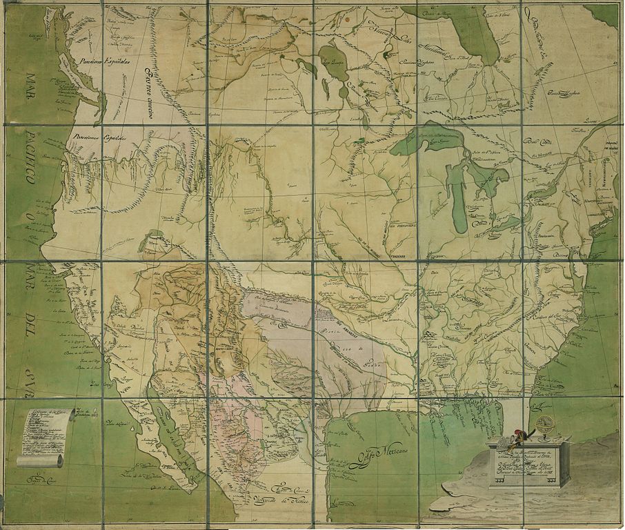
| Description |
English: Map of the "internal provinces" of the viceroyalty of New Spain, 1817. Red lines represent Spanish expeditions and the yellow lines U.S. expeditions
Español: Mapa de las "Provincias Ynternas" del virreinato de Nueva España, 1817. Las líneas rojas indican expediciones españolas y las amarillas estadounidenses. |
| Date | |
| Source | Real Academia de la Historia |
| Author | José Caballero, capitán de artillería provincial de Nueva Vizcaya |
Licensing
|
This work is in the public domain in its country of origin and other countries and areas where the copyright term is the author's life plus 100 years or fewer. | |
| This file has been identified as being free of known restrictions under copyright law, including all related and neighboring rights. | |
Información suplementaria en el sitio web de la RAH
File history
Click on a date/time to view the file as it appeared at that time.
| Date/Time | Thumbnail | Dimensions | User | Comment | |
|---|---|---|---|---|---|
| current | 05:41, 28 July 2012 |
| 8,866 × 7,520 (8.11 MB) | Hispalois | {{Information |Description ={{en|1=Map of the "internal provinces" of the viceroyalty of New Spain, 1817. Red lines represent Spanish expeditions and the yellow lines U.S. expeditions}} {{es|1=Mapa de las "Provincias Ynternas" del virreinato de Nuev... |
File usage
The following pages on the English Wikipedia use this file (pages on other projects are not listed):
Global file usage
The following other wikis use this file:
- Usage on ast.wikipedia.org
- Usage on ca.wikipedia.org
- Usage on es.wikipedia.org
- Usage on it.wikipedia.org
- Usage on mt.wikipedia.org
- Usage on ru.wikipedia.org
- Usage on uk.wikipedia.org