
Size of this PNG preview of this SVG file:
800 × 345 pixels. Other resolutions:
320 × 138 pixels |
640 × 276 pixels |
1,024 × 441 pixels |
1,280 × 551 pixels |
2,560 × 1,103 pixels |
6,770 × 2,916 pixels.
Original file (SVG file, nominally 6,770 × 2,916 pixels, file size: 127 KB)
| This is a file from the
Wikimedia Commons. Information from its
description page there is shown below. Commons is a freely licensed media file repository. You can help. |
Summary
| Description |
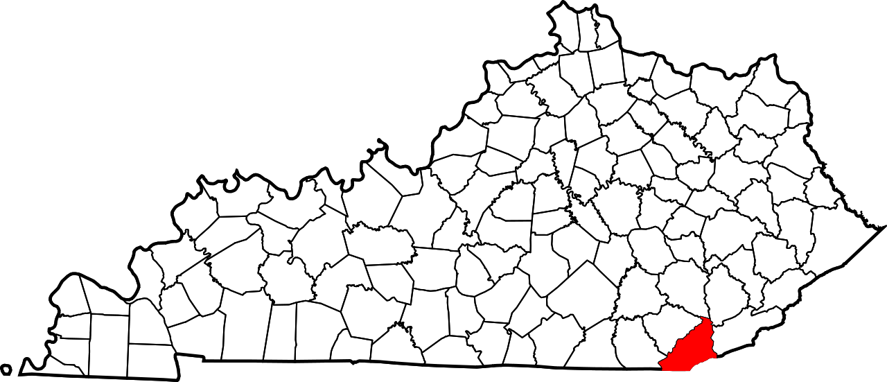
English: This is a locator map showing
Bell County in Kentucky. For more information, see
Commons:United States county locator maps. |
| Date | |
| Source |
Own work: English: The maps use data from
nationalatlas.gov, specifically
countyp020.tar.gz on the
Raw Data Download page. The maps also use state outline data from
statesp020.tar.gz. The Florida maps use
hydrogm020.tar.gz to display Lake Okeechobee. |
| Author | David Benbennick |
Licensing
| I, the copyright holder of this work, release this work into the
public domain. This applies worldwide. In some countries this may not be legally possible; if so: I grant anyone the right to use this work for any purpose, without any conditions, unless such conditions are required by law. |
File history
Click on a date/time to view the file as it appeared at that time.
| Date/Time | Thumbnail | Dimensions | User | Comment | |
|---|---|---|---|---|---|
| current | 12:20, 12 February 2006 |
| 6,770 × 2,916 (127 KB) | David Benbennick | {{subst:User:Dbenbenn/clm|county=Bell County|state=Kentucky}} |
File usage
The following pages on the English Wikipedia use this file (pages on other projects are not listed):
- Arjay, Kentucky
- Balkan, Kentucky
- Bell County, Kentucky
- Black Snake, Kentucky
- Blackmont, Kentucky
- Calvin, Kentucky
- Cannon Creek Lake
- Clear Creek (Kentucky)
- Clear Creek Springs, Kentucky
- Clear Fork (Cumberland River tributary)
- Colmar, Kentucky
- Cubage, Kentucky
- Eastern Kentucky Coalfield
- Field, Kentucky
- Fonde, Kentucky
- Fourmile, Kentucky
- Frakes, Kentucky
- Glendon Coal Camp, Kentucky
- Harbell, Bell County, Kentucky
- Hutch, Kentucky
- Ingram, Kentucky
- Jaybel, Kentucky
- Keenox, Kentucky
- Kettle Island, Kentucky
- Kettle Island Coal Camp, Kentucky
- List of counties in Kentucky
- Martin's Fork (Cumberland River tributary)
- Meldrum, Bell County, Kentucky
- Middlesboro, Kentucky
- Miracle, Bell County, Kentucky
- National Register of Historic Places listings in Bell County, Kentucky
- Noetown, Kentucky
- Nugym, Kentucky
- Oaks, Bell County, Kentucky
- Olcott, Bell County, Kentucky
- Pineville, Kentucky
- Ponza, Bell County, Kentucky
- Premier, Bell County, Kentucky
- Pruden, Kentucky and Tennessee
- Red Bird River
- Red Oak, Bell County, Kentucky
- Rella, Bell County, Kentucky
- Rim Camp, Kentucky
- Rocky Face Fault
- Stoney Fork, Kentucky
- Stony Fork Junction, Kentucky
- Tejay, Kentucky
- Timsley, Kentucky
- Tri-State Peak
- Tuggleville, Kentucky
- Varilla, Kentucky
- Wallsend, Kentucky
- Wasioto, Kentucky
- Yellow Creek, Bell County, Kentucky
- User:Nyttend/County templates/KY/1
- Template:BellCountyKY-geo-stub
- Template:Bell County, Kentucky
- Category:Populated places in Bell County, Kentucky
Global file usage
The following other wikis use this file:
- Usage on ar.wikipedia.org
- Usage on bg.wikipedia.org
- Usage on bpy.wikipedia.org
- Usage on cdo.wikipedia.org
- Usage on ceb.wikipedia.org
- Usage on ce.wikipedia.org
- Usage on cs.wikipedia.org
- Usage on cy.wikipedia.org
- Usage on de.wikipedia.org
- Usage on es.wikipedia.org
- Usage on et.wikipedia.org
- Usage on eu.wikipedia.org
- Usage on fa.wikipedia.org
- Usage on fa.wikivoyage.org
- Usage on frr.wikipedia.org
- Usage on fr.wikipedia.org
- Usage on hu.wikipedia.org
- Usage on hy.wikipedia.org
- Usage on it.wikipedia.org
- Usage on ja.wikipedia.org
- Usage on ko.wikipedia.org
- Usage on nds.wikipedia.org
- Usage on nl.wikipedia.org
- Usage on pl.wikipedia.org
- Usage on pnb.wikipedia.org
- Usage on pt.wikipedia.org
- Usage on ro.wikipedia.org
- Usage on ru.wikipedia.org
- Usage on sh.wikipedia.org
View more global usage of this file.