Size of this JPG preview of this TIF file:
752 × 599 pixels. Other resolutions:
301 × 240 pixels |
602 × 480 pixels |
964 × 768 pixels |
1,280 × 1,020 pixels |
2,560 × 2,041 pixels |
4,993 × 3,980 pixels.
Original file (4,993 × 3,980 pixels, file size: 18.95 MB, MIME type: image/tiff)
| This is a file from the
Wikimedia Commons. Information from its
description page there is shown below. Commons is a freely licensed media file repository. You can help. |
Summary
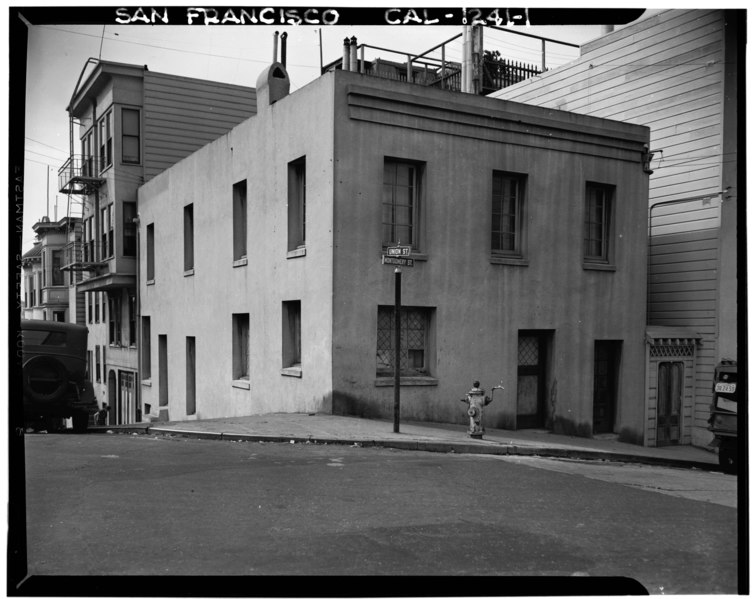
| Historic American Buildings Survey A. J. Wittlock, Photographer March 1940 TELEGRAPH HILL AND MONTGOMERY STREET HOUSES - Telegraph Hill (House), 1301 Montgomery Street, San Francisco, San Francisco County, CA | ||||
|---|---|---|---|---|
| Title |
Historic American Buildings Survey A. J. Wittlock, Photographer March 1940 TELEGRAPH HILL AND MONTGOMERY STREET HOUSES - Telegraph Hill (House), 1301 Montgomery Street, San Francisco, San Francisco County, CA |
|||
| Depicted place | California; San Francisco County; San Francisco | |||
| Dimensions | 4 x 5 in. | |||
| Current location |
Library of Congress Prints and Photographs Division Washington, D.C. 20540 USA
http://hdl.loc.gov/loc.pnp/pp.print |
|||
| Accession number |
HABS CAL,38-SANFRA,126-1 |
|||
| Credit line |
|
|||
| Source | https://www.loc.gov/pictures/item/ca0734.photos.016076p | |||
| Permission ( Reusing this file) |
|
|||

| Camera location |
| View this and other nearby images on: OpenStreetMap |
|
|---|
File history
Click on a date/time to view the file as it appeared at that time.
| Date/Time | Thumbnail | Dimensions | User | Comment | |
|---|---|---|---|---|---|
| current | 00:20, 4 July 2014 |
 | 4,993 × 3,980 (18.95 MB) | Fæ | GWToolset: Creating mediafile for Fæ. HABS 3 July 2014 (201:300) |
File usage
The following pages on the English Wikipedia use this file (pages on other projects are not listed):