No higher resolution available.
HUC_031300010703_-_Latham_Creek-Chestatee_River.tiff (608 × 598 pixels, file size: 758 KB, MIME type: image/tiff)
| This is a file from the
Wikimedia Commons. Information from its
description page there is shown below. Commons is a freely licensed media file repository. You can help. |
Summary
| Description |
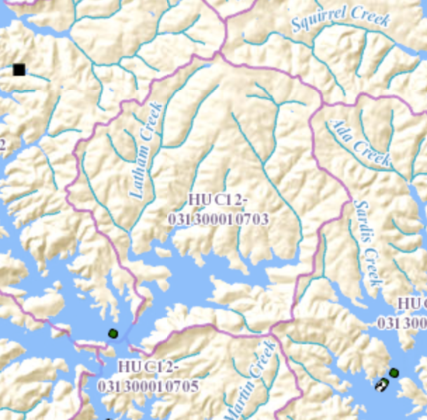
English: HUC 031300010703 - Map shows Latham Creek flowing from north, joining the Chestatee River arm of Lake Lanier in the southwestern part of the map. |
| Date | |
| Source | http://viewer.nationalmap.gov/viewer/nhd.html?p=nhd&b=base1&q=031300010703&x=-9341311.455228325&y=4076853.5371689154&l=12&v= |
| Author | USGS |
Licensing
This image is in the
public domain in the United States because it only contains materials that originally came from the
United States Geological Survey, an agency of the
United States Department of the Interior. For more information, see
the official USGS copyright policy.
|
File history
Click on a date/time to view the file as it appeared at that time.
| Date/Time | Thumbnail | Dimensions | User | Comment | |
|---|---|---|---|---|---|
| current | 00:45, 8 January 2016 |
 | 608 × 598 (758 KB) | Concertmusic | User created page with UploadWizard |
File usage
The following pages on the English Wikipedia use this file (pages on other projects are not listed):