
Size of this JPG preview of this TIF file:
741 × 600 pixels. Other resolutions:
297 × 240 pixels |
593 × 480 pixels |
949 × 768 pixels |
1,265 × 1,024 pixels |
2,531 × 2,048 pixels |
5,019 × 4,062 pixels.
Original file (5,019 × 4,062 pixels, file size: 19.45 MB, MIME type: image/tiff)
| This is a file from the
Wikimedia Commons. Information from its
description page there is shown below. Commons is a freely licensed media file repository. You can help. |
Summary
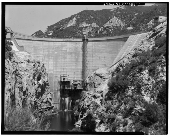
| DOWNSTREAM ELEVATION VIEW OF BIG TUJUNGA DAM, FACING EAST. - Big Tujunga Dam, 809 West Big Tujunga Road, Sunland, Los Angeles County, CA | ||||
|---|---|---|---|---|
| Photographer |
Miller, Monticello Related names:
|
|||
| Title |
DOWNSTREAM ELEVATION VIEW OF BIG TUJUNGA DAM, FACING EAST. - Big Tujunga Dam, 809 West Big Tujunga Road, Sunland, Los Angeles County, CA |
|||
| Depicted place | California; Los Angeles County; Sunland | |||
| Date | 2000 | |||
| Dimensions | 4 x 5 in. | |||
| Current location |
Library of Congress Prints and Photographs Division Washington, D.C. 20540 USA
http://hdl.loc.gov/loc.pnp/pp.print |
|||
| Accession number |
HAER CAL,19-SUNL.V,1-1 |
|||
| Credit line |
|
|||
| Notes |
|
|||
| Source | https://www.loc.gov/pictures/item/ca2932.photos.382872p | |||
| Permission ( Reusing this file) |
|
|||

| Object location |
| View this and other nearby images on: OpenStreetMap |
|
|---|
File history
Click on a date/time to view the file as it appeared at that time.
| Date/Time | Thumbnail | Dimensions | User | Comment | |
|---|---|---|---|---|---|
| current | 00:08, 6 July 2014 |
 | 5,019 × 4,062 (19.45 MB) | Fæ | GWToolset: Creating mediafile for Fæ. HABS 05 July 2014 (501:600) |
File usage
The following pages on the English Wikipedia use this file (pages on other projects are not listed):