Size of this preview:
534 × 599 pixels. Other resolutions:
214 × 240 pixels |
428 × 480 pixels |
685 × 768 pixels |
913 × 1,024 pixels |
1,364 × 1,530 pixels.
Original file (1,364 × 1,530 pixels, file size: 1.9 MB, MIME type: image/png)
| This is a file from the
Wikimedia Commons. Information from its
description page there is shown below. Commons is a freely licensed media file repository. You can help. |

|
This map image could be re-created using
vector graphics as an
SVG file. This has several advantages; see
Commons:Media for cleanup for more information. If an SVG form of this image is available, please upload it and afterwards replace this template with
{{
vector version available|new image name}}
.
It is recommended to name the SVG file “California Mountain Ranges.svg”—then the template Vector version available (or Vva) does not need the new image name parameter. |
| Description |
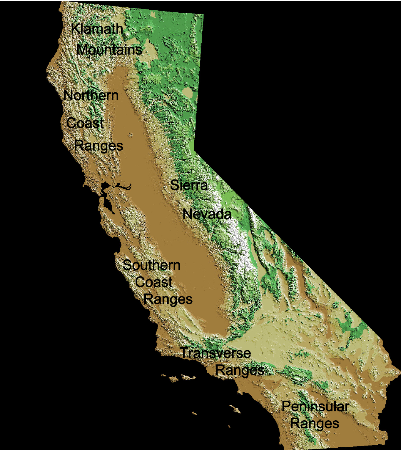
English: Mountain ranges of California:
Deutsch: Kalifornische Küstenketten |
| Date | |
| Source |
Original map:
http://wwwflag.wr.usgs.gov/USGSFlag/Data/maps/ |
| Author |
Original map: USGS |
| Other versions |
Map:
This image is in the
public domain in the United States because it only contains materials that originally came from the
United States Geological Survey, an agency of the
United States Department of the Interior. For more information, see
the official USGS copyright policy.
|
Edits:
| This work has been released into the
public domain by its author,
Jo Weber. This applies worldwide. In some countries this may not be legally possible; if so: |
File history
Click on a date/time to view the file as it appeared at that time.
| Date/Time | Thumbnail | Dimensions | User | Comment | |
|---|---|---|---|---|---|
| current | 21:12, 3 May 2009 |
| 1,364 × 1,530 (1.9 MB) | Jo Weber | {{Information |Description= {{en|California Coast Ranges}} {{de|Kalifornische Küstenketten}} |Source= File:Digital-elevation-map-california.gif |Date=2009-05-03 |Author=USGS / [[User:|Jo]] |Permission=see below |other_versions=[[:File:Digital-elevati |
File usage
No pages on the English Wikipedia use this file (pages on other projects are not listed).
Global file usage
The following other wikis use this file:
- Usage on cs.wikipedia.org
- Usage on de.wikipedia.org
- Usage on eo.wikipedia.org
- Usage on es.wikipedia.org
- Usage on frr.wikipedia.org
- Usage on fr.wikipedia.org
- Usage on it.wikipedia.org