Size of this preview:
800 × 600 pixels. Other resolutions:
320 × 240 pixels |
640 × 480 pixels |
1,024 × 768 pixels |
1,280 × 960 pixels |
2,560 × 1,920 pixels.
Original file (2,560 × 1,920 pixels, file size: 1.06 MB, MIME type: image/jpeg)
| This is a file from the
Wikimedia Commons. Information from its
description page there is shown below. Commons is a freely licensed media file repository. You can help. |
| Description |
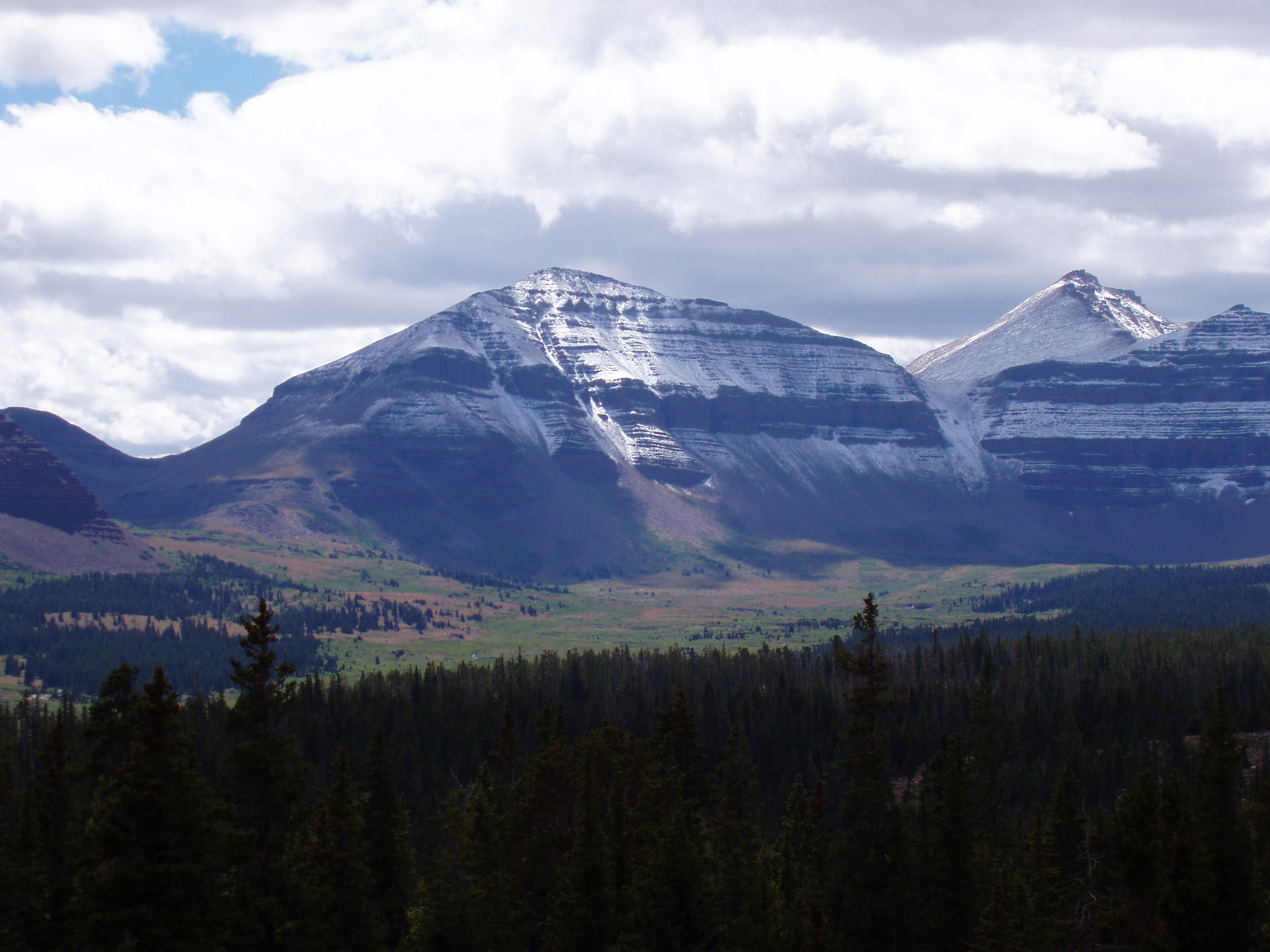
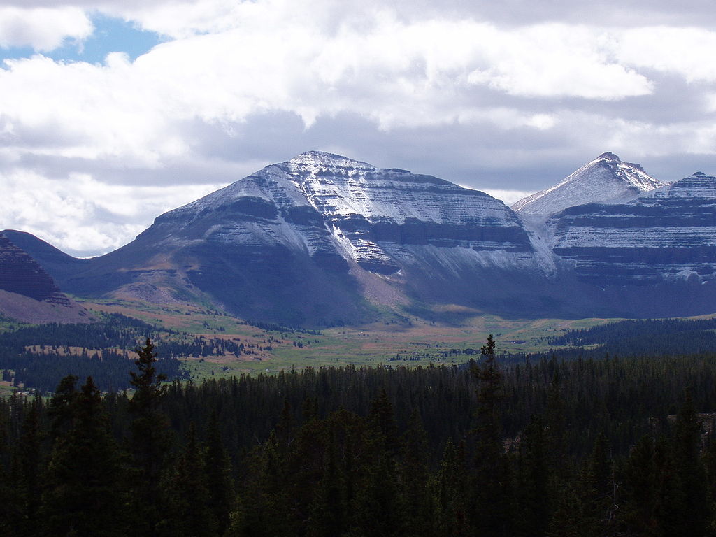
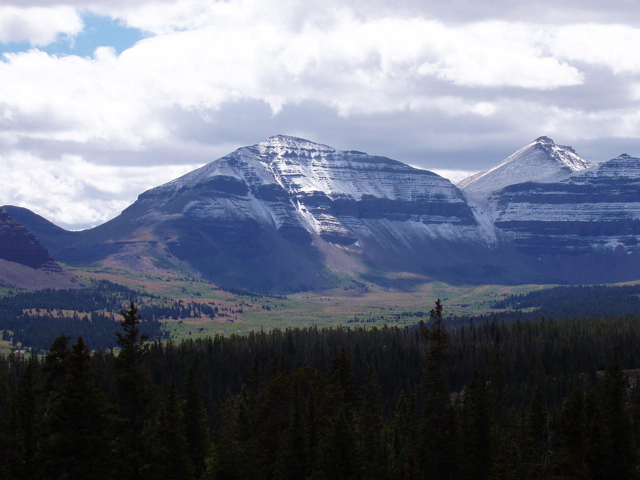
English: Close-up shot of Kings Peak (Utah, USA) as seen from the north. Kings Peak is on the right, and Gunsight Pass is on the far left. (Wouldn't it be better to say Kings Peak is in the center, Gunsight Pass is on the left, and another peak (which?) is on the right which superficially appears taller but is not, due to this photo being taken from above somehow? --Doncram) |
||||||||
| Date | |||||||||
| Source | Work by author | ||||||||
| Author | Hyrum K. Wright | ||||||||
| Permission ( Reusing this file) |
|

File history
Click on a date/time to view the file as it appeared at that time.
| Date/Time | Thumbnail | Dimensions | User | Comment | |
|---|---|---|---|---|---|
| current | 12:32, 26 July 2006 |
| 2,560 × 1,920 (1.06 MB) | Enlarge | Photo taken by Hyrum K. Wright on August 25, 2004. Close-up shot of Kings Peak as seen from the north. Kings Peak is on the right, and Gunsight Pass is on the far left. http://en.wikipedia.org/wiki/Image:Kings_Peak_Close_Up.jpg |
File usage
The following pages on the English Wikipedia use this file (pages on other projects are not listed):
- List of U.S. states and territories by elevation
- List of mountain peaks of North America
- List of mountain peaks of Utah
- List of mountains in Utah
- List of mountains of the United States
- List of the highest major summits of North America
- List of the highest major summits of the United States
- List of the major 100-kilometer summits of North America
- List of the major 3000-meter summits of the Rocky Mountains
- List of the most isolated major summits of the United States
- List of the most prominent summits of the United States
- List of ultras of North America
- Thirteener
- Portal:Utah/DYK
- Portal:Utah/DYK/6
Global file usage
The following other wikis use this file:
- Usage on ar.wikipedia.org
- Usage on arz.wikipedia.org
- Usage on be.wikipedia.org
- Usage on ceb.wikipedia.org
- Usage on cs.wikipedia.org
- Usage on de.wikipedia.org
- Usage on en.wikivoyage.org
- Usage on es.wikipedia.org
- Usage on et.wikipedia.org
- Usage on fr.wikipedia.org
- Usage on lld.wikipedia.org
- Usage on lt.wikipedia.org
- Usage on nl.wikipedia.org
- Usage on no.wikipedia.org
- Usage on pl.wikipedia.org
- Usage on pnb.wikipedia.org
- Usage on pt.wikipedia.org
- Usage on ro.wikipedia.org
- Usage on ru.wikipedia.org
- Usage on simple.wikipedia.org
- Usage on sk.wikipedia.org
- Usage on uk.wikipedia.org
- Usage on www.wikidata.org
- Usage on zh.wikipedia.org