Chulafinnee, Alabama | |
|---|---|
 Chulafinnee, Alabama  Chulafinnee, Alabama | |
| Coordinates: 33°32′43″N 85°38′56″W / 33.54528°N 85.64889°W | |
| Country | United States |
| State | Alabama |
| County | Cleburne |
| Elevation | 876 ft (267 m) |
| Time zone | UTC-6 ( Central (CST)) |
| • Summer ( DST) | UTC-5 (CDT) |
| GNIS feature ID | 159405 [1] |
Chulafinnee is an unincorporated community in Cleburne County, Alabama, United States.
History
Chulafinnee was named after the nearby Chulafinnee Creek, which was derived from Creek words chuli meaning "pine" and fina meaning "footlog". [2] Chulafinnee was founded in 1835 when gold was found in the nearby creeks. The population was smaller than that of nearby Arbacoochee (which was also formed after gold was found nearby), but considered by locals to be a more permanent town due to the greater number of brick buildings. Local lore held that the King brothers, (who later founded King Ranch), were prospectors in the area. [3] Remains of some of the mines are located on the Frank Spain Scout Reservation, where participating Scouts are able to learn about the history of the area. [4]
The American geologist Eugene Allen Smith explored the old mines and examined minerals around Chulafinnee in the late 1800s. [5]
A post office operated under the name Chulafinnee from 1842 to 1904. [6]
References
- ^ "Chulafinnee". Geographic Names Information System. United States Geological Survey, United States Department of the Interior.
- ^ Read, William A. (1984). Indian Place Names in Alabama. Tuscaloosa: The University of Alabama Press. p. 20. ISBN 0-8173-0231-X.
- ^ Harris, W. Stuart (1977). Dead Towns of Alabama. Tuscaloosa, Alabama: University of Alabama Press. p. 71. ISBN 0-8173-1125-4.
- ^ "Striplin Gold Mine and Carr Creek Placer" (PDF). Alabama Register of Landmarks and Heritage. Retrieved November 7, 2019.
- ^ Aileen Kilgore Henderson (2011). Eugene Allen Smith's Alabama: How a Geologist Shaped a State. NewSouth Books. p. 7. ISBN 978-1-58838-243-6.
- ^ "Cleburne County". Jim Forte Postal History. Retrieved November 7, 2019.
Municipalities and communities of
Cleburne County, Alabama, United States | ||
|---|---|---|
| City | 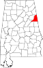 | |
| Towns | ||
| CDP | ||
|
Unincorporated communities | ||
|
| This Cleburne County, Alabama state location article is a stub. You can help Wikipedia by expanding it. |