Arbacoochee, Alabama | |
|---|---|
 1922 fire insurance map of Arbacoochee | |
 Arbacoochee, Alabama  Arbacoochee, Alabama | |
| Coordinates: 33°34′34″N 85°31′02″W / 33.57611°N 85.51722°W | |
| Country | United States |
| State | Alabama |
| County | Cleburne |
| Elevation | 961 ft (293 m) |
| Time zone | UTC-6 ( Central (CST)) |
| • Summer ( DST) | UTC-5 (CDT) |
| GNIS feature ID | 159079 |
Arbacoochee is an unincorporated community in Cleburne County, Alabama, United States.
History
Arbacoochee was named after the old Creek Indian village of "Abihkuchi", which translates to "a pile at the base." [1] Gold was discovered here in 1832, and the local mines produced over $5,000,000 worth of gold. In 1845, Arbacoochee had a population of over 5,000 people and was home to twenty general stores, five saloons, a school, two churches, two hotels, two mining supply stores, a fire department, race track, and over 100 homes. [2] Most of the residents departed when news of the California Gold Rush reached Alabama, and only a few families remained. [3]
A post office was operated in Arbacoochee from 1842 to 1904. [4]
Demographics
Arbacoochee
| Census | Pop. | Note | %± |
|---|---|---|---|
| 1880 | 50 | — | |
| U.S. Decennial Census [5] | |||
Arbacoochee first appeared on the 1880 U.S. Census as an unincorporated village and as the 10th beat/precinct of Cleburne County (see below). The population of the village made it the second largest community in the county behind the then-county seat of Edwardsville. [6] The village did not report again on the census, although the precinct bearing its name continued to report until 1950.
Historic Demographics
| Census Year |
Population | State Place Rank |
County Place Rank |
|---|---|---|---|
| 1880 [a] [6] | 50 (-) [b] [c] | 211th (-) | 2nd (-) |
Arbacoochee Precinct (1880-1950)
| Census | Pop. | Note | %± |
|---|---|---|---|
| 1880 | 877 | — | |
| 1890 | 1,046 | 19.3% | |
| 1900 | 896 | −14.3% | |
| 1910 | 899 | 0.3% | |
| 1920 | 833 | −7.3% | |
| 1930 | 1,084 | 30.1% | |
| 1940 | 826 | −23.8% | |
| 1950 | 607 | −26.5% | |
| U.S. Decennial Census [7] | |||
The Arbacoochee Beat (Precinct) (Cleburne County 10th Beat) first appeared on the 1880 U.S. Census. It was changed from "beat" to "precinct" in 1890. The precinct continued to report until 1950. In 1960, the precinct was merged as part of a larger reorganization of counties into the census division of Heflin. [8]
Notable people
- Seaborn McDaniel Denson and Thomas Jackson Denson, musicians and singing school teachers within the Sacred Harp tradition
References
Notes
References
- ^ "Arbacoochee". Geographic Names Information System. United States Geological Survey, United States Department of the Interior.
- ^ Plott, Bill (August 10, 1970). "Gold Mining Still Going On in Alabama". The Tuscaloosa News. Tuscaloosa: Tim Thompson. Retrieved June 2, 2014.
- ^ "Arbachoochee (Arbacoochee) Alabama". Ghosttownsandmines.com. November 20, 2010. Retrieved June 2, 2014.
- ^ "Cleburne County". Jim Forte Postal History. Archived from the original on November 29, 2014. Retrieved November 20, 2014.
- ^ "U.S. Decennial Census". Census.gov. Archived from the original on May 7, 2015. Retrieved June 6, 2013.
- ^ a b "Table III - Population of Civil Divisions less than counties, in the aggregate at the Censuses of 1880 and 1870" (PDF). United States Census Bureau. 1880.
- ^ "U.S. Decennial Census". Census.gov. Retrieved June 6, 2013.
- ^ "Number of Inhabitants - Alabama" (PDF). United States Census Bureau. 1960.
Municipalities and communities of
Cleburne County, Alabama, United States | ||
|---|---|---|
| City | 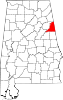 | |
| Towns | ||
| CDP | ||
|
Unincorporated communities | ||
|
| This Cleburne County, Alabama state location article is a stub. You can help Wikipedia by expanding it. |