Cedar Grove, Henderson County, Tennessee | |
|---|---|
 Cedar Grove  Cedar Grove | |
| Coordinates: 35°28′55″N 88°16′04″W / 35.48194°N 88.26778°W | |
| Country | United States |
| State | Tennessee |
| County | Henderson |
| Elevation | 486 ft (148 m) |
| Time zone | UTC-6 ( Central (CST)) |
| • Summer ( DST) | UTC-5 (CDT) |
| Area code | 731 |
| GNIS feature ID | 1280027 [1] |
Cedar Grove is an unincorporated community in Henderson County, Tennessee, United States. [1] Cedar Grove is located on Tennessee State Route 104, northwest of Lexington. [2]
References
- ^ a b "Cedar Grove". Geographic Names Information System. United States Geological Survey, United States Department of the Interior.
- ^ Henderson County, Tennessee General Highway Map (PDF) (Map). Tennessee Department of Transportation. 2002. Retrieved November 13, 2012.
Municipalities and communities of
Henderson County, Tennessee, United States | ||
|---|---|---|
| Cities | 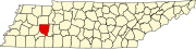 | |
| Towns | ||
| CDPs | ||
|
Other communities | ||
| Footnotes | ‡This populated place also has portions in an adjacent county or counties | |
|
| This Henderson County, Tennessee geography–related article is a stub. You can help Wikipedia by expanding it. |