Ballinamuck
Béal Átha na Muc | |
|---|---|
Village | |
 Pikemen memorial in Ballinamuck | |
| Motto: Is glas iad na cnoic i bhfad uainn / The faraway hills are green. | |
| Coordinates: 53°52′00″N 7°43′00″W / 53.866667°N 7.716667°W | |
| Country | Ireland |
| Province | Leinster |
| County | County Longford |
| Elevation | 82 m (269 ft) |
| Time zone | UTC+0 ( WET) |
| • Summer ( DST) | UTC-1 ( IST ( WEST)) |
| Irish Grid Reference | N184907 |
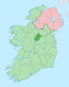
Ballinamuck ( Irish: Béal Átha na Muc, meaning "mouth of the pig's ford") [1] is a village in north County Longford, Ireland. It is around 15 km north of Longford town.
It was the scene of the Battle of Ballinamuck, where a French army aiding the United Irishmen rebellion of 1798 was defeated. The French soldiers were eventually repatriated. The Irish prisoners were taken to St Johnstown - today's Ballinalee - where they were executed in what is known locally as Bullys Acre and buried there. Ballinamuck is twinned with the French town of Essert.
Transport
Whartons Travel operates bus route 975 on behalf of the National Transport Authority. It serves the village six times a day (not Sundays) providing services to Longford via Drumlish and to Cavan via Arva. [2] [3] Bus Éireann route 463 ( Carrigallen- Longford) serves the village on Wednesdays. The nearest rail services can be accessed at Longford railway station.
References
- ^ "Béal Átha na Muc/Ballinamuck". Placenames Database of Ireland (logainm.ie). Retrieved 8 October 2021.
- ^ "Route 975 Cavan – Arvagh- Longford Bus Service Commences". nationaltransport.ie. Archived from the original on 18 December 2017. Retrieved 7 August 2014.
- ^ "Longford Bus - Route 975 Timetable". whartonstravel.com. Archived from the original on 22 December 2015. Retrieved 19 December 2015.

