This article needs additional citations for
verification. (January 2013) |
Anzegem | |
|---|---|
 | |
| Coordinates: 50°50′N 03°28′E / 50.833°N 3.467°E | |
| Country | |
| Community | Flemish Community |
| Region | Flemish Region |
| Province | West Flanders |
| Arrondissement | Kortrijk |
| Government | |
| • Mayor | Gino Devogelaere (Samen Eén) |
| • Governing party/ies | Samen Eén, Inzet, N-VA |
| Area | |
| • Total | 42.35 km2 (16.35 sq mi) |
| Population (2018-01-01)
[1] | |
| • Total | 14,609 |
| • Density | 340/km2 (890/sq mi) |
| Postal codes | 8570, 8572, 8573 |
| NIS code | 34002 |
| Area codes | 056 |
| Website | www.anzegem.be |
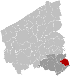
Anzegem (Dutch pronunciation: [ˈɑnzəɣɛm] ⓘ) is a municipality located in the Belgian province of West Flanders. The municipality comprises the towns of Anzegem proper, Gijzelbrechtegem, Ingooigem, Kaster, Tiegem and Vichte. On 1 January 2006 Anzegem had a total population of 14,609. The total area is 41.79 km² which gives a population density of 349 inhabitants per km².
One of the most famous inhabitants of Anzegem was Stijn Streuvels, the Flemish writer who died in Ingooigem in 1969, aged 98.
On the night of 16 October 2014, Anzegem's medieval parish church of Saint John the Baptist (Sint Jan de Doperkerk in Dutch) was destroyed in a fire. [2]

References
- ^ "Wettelijke Bevolking per gemeente op 1 januari 2018". Statbel. Retrieved 9 March 2019.
- ^ "Huge fire destroys Belgian church". BBC News. 17 October 2014. Retrieved 17 October 2014.
External links
-
 Media related to
Anzegem at Wikimedia Commons
 - Official website – Available only in Dutch


