Sarcoxie Township | |
|---|---|
 Location in Jefferson County | |
| Coordinates: 39°05′45″N 95°14′01″W / 39.09583°N 95.23361°W | |
| Country | United States |
| State | Kansas |
| County | Jefferson |
| Area | |
| • Total | 31.03 sq mi (80.36 km2) |
| • Land | 30.89 sq mi (80 km2) |
| • Water | 0.14 sq mi (0.36 km2) 0.45% |
| Elevation | 1,014 ft (309 m) |
| Population (
2000) | |
| • Total | 958 |
| • Density | 31/sq mi (12/km2) |
| GNIS feature ID | 0478519 |
Sarcoxie Township is a township in Jefferson County, Kansas, USA. As of the 2000 census, its population was 958.
Geography
Sarcoxie Township covers an area of 31.03 square miles (80.36 square kilometers); of this, 0.14 square miles (0.36 square kilometers) or 0.45 percent is water. The stream of Plum Creek runs through this township.
Adjacent townships
- Union Township (north)
- Tonganoxie Township, Leavenworth County (northeast)
- Reno Township, Leavenworth County (southeast)
- Grant Township, Douglas County (south)
- Rural Township (west)
- Oskaloosa Township (northwest)
Cemeteries
The township contains one cemetery, Hardy Oak.
Major highways
References
External links
Municipalities and communities of
Jefferson County, Kansas, United States | ||
|---|---|---|
| Cities | 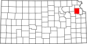 | |
|
Unincorporated communities | ||
| Townships | ||
| Footnotes | †This community is designated a
Census-Designated Place (CDP) by the
United States Census Bureau. | |
|
| This article about a location in Jefferson County, Kansas is a stub. You can help Wikipedia by expanding it. |