Kentucky Township | |
|---|---|
 Location in Jefferson County | |
| Coordinates: 39°06′30″N 95°25′06″W / 39.10833°N 95.41833°W | |
| Country | United States |
| State | Kansas |
| County | Jefferson |
| Area | |
| • Total | 41.56 sq mi (107.63 km2) |
| • Land | 36.08 sq mi (93.45 km2) |
| • Water | 5.48 sq mi (14.18 km2) 13.17% |
| Elevation | 850 ft (259 m) |
| Population (
2000) | |
| • Total | 1,576 |
| • Density | 43.7/sq mi (16.9/km2) |
| GNIS feature ID | 0478495 |
Kentucky Township is a township in Jefferson County, Kansas, USA. As of the 2000 census, its population was 1,576.
Geography
Kentucky Township covers an area of 41.56 square miles (107.63 square kilometers); of this, 5.48 square miles (14.18 square kilometers) or 13.17 percent is water. The streams of Delaware River, Little Wild Horse Creek and Slough Creek run through this township.
Cities and towns
Unincorporated towns
(This list is based on USGS data and may include former settlements.)
Adjacent townships
- Fairview Township (north)
- Oskaloosa Township (northeast)
- Rural Township (east)
- Lecompton Township, Douglas County (south)
- Kaw Township (west)
Cemeteries
The township contains three cemeteries: Mount Calvary, Newman and Perry.
Major highways
References
External links
Municipalities and communities of
Jefferson County, Kansas, United States | ||
|---|---|---|
| Cities | 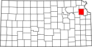 | |
|
Unincorporated communities | ||
| Townships | ||
| Footnotes | †This community is designated a
Census-Designated Place (CDP) by the
United States Census Bureau. | |
|
| This article about a location in Jefferson County, Kansas is a stub. You can help Wikipedia by expanding it. |