This article has multiple issues. Please help
improve it or discuss these issues on the
talk page. (
Learn how and when to remove these template messages)
|
| Zaleski State Forest | |
|---|---|
| Zaleski Forest | |
IUCN category V (protected landscape/seascape) | |
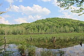
 View from a hiking trail in the forest | |
| Location | Vinton County and Athens County, Ohio |
| Nearest city | Wellston, OH |
| Area | 28,000 acres (110 km2) |
| Governing body | Ohio Department of Natural Resources |
Zaleski State Forest is a state forest in the U.S. state of Ohio, located primarily in Vinton County, with areas in Athens County as well. The 28,000 acre (110 km²) forest surrounds Lake Hope State Park in Vinton County, and borders the Waterloo Wildlife Research Station in Athens County.
Part of the Zaleski Mound Group, a group of Native American mounds built by the prehistoric Adena culture, is located within the forest. [1]
The forest is located in the rugged hills of the unglaciated Allegheny Plateau in Southern Ohio, with elevations ranging up to about 1100 feet above sea level. The historic Hope Furnace can be seen at Lake Hope State Park, just across the road from the forest.
References
- ^ Owen, Lorrie K., ed. Dictionary of Ohio Historic Places. Vol. 2. St. Clair Shores: Somerset, 1999, 1369.
External links
- Ohio Dept. of Natural Resources: Zaleski State Forest
- U.S. Geological Survey Map at the U.S. Geological Survey Map Website. Retrieved November 14th, 2022.

