 首都高速神奈川1号横羽線 | |
|---|---|
 The Yokohane Route is highlighted in orange | |
| Route information | |
| Maintained by Metropolitan Expressway Company Limited | |
| Length | 19.7 km (12.2 mi) |
| Existed | 1968–present |
| Major junctions | |
| North end |
Haneda entrance/exit in
Ōta, Tokyo |
| South end |
Ishikawachō Junction in
Naka-ku, Yokohama,
Kanagawa |
| Location | |
| Country | Japan |
| Highway system | |
The Yokohane Route (横羽線, Yokohane-sen), signed as Route K1, is one of the tolled routes of the Shuto Expressway system serving the Greater Tokyo Area and is one of seven of the routes in the system serving Kanagawa Prefecture. The route is a 19.7-kilometer (12.2 mi) long radial highway running southwest from the southern terminus of the Haneda Route in Ōta near Haneda International Airport in Tokyo to the Kariba Route in Naka-ku, Yokohama in Kanagawa Prefecture. Alongside the Haneda Route, it connects Tokyo's Inner Circular Route in central Tokyo to Yokohama.
Route description
Route K1 begins at the Haneda interchange in Ōta as a continuation south for the Haneda Route into Kanagawa Prefecture. From this northern terminus, it travels southwest out of Tokyo, crossing in to the eastern part of the city of Kawasaki in Kanagawa Prefecture. The largest junction along the Yokohane Route in Kawasaki is at Daishi Junction where the highway meets the Kawasaki Route at its western terminus. In Yokohama, the expressway intersects the Yokohama North Route, the Daikoku Route, National Route 15, the Mitsuzawa Route, and National Route 1. Route K1 meets its southern terminus at Ishikawachō Junction with the Kariba Route. [1]
The speed limit along almost the entire length of the Yokohane Route is set at 60 km/h. The only exception is at the southern terminus of the route between Yokohama-kōen and Ishikawachō Junction where the limit is lowered to 50 km/h. [2]
History
The first section of the Yokohane Route was opened to traffic on 19 July 1968 between the interchanges at Asada and Higashikanagawa. Later that year, on 28 November, the expressway was extended north to its current northern terminus at Haneda. Next it was extended south to Kinkō Junction on 7 August 1972. It was extended further to the south, terminating at an interchange at Yokohama-kōen on 7 March 1978. The Yokohane Route was completed upon completion of its extension south to its southern terminus at Ishikawachō Junction on 2 February 1984. [3] Work began in 2015 to replace the Daichi Bridge that carries that expressway over the Tama River after fatigue cracks were found throughout the old bridge. The replacement project is set to be completed in 2023. [4]
Gallery
- Yokohane Route
-
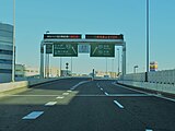
 The northern terminus of the route at Haneda
 -
 The Daishi Bridge over the Tama River. The Yokohane Route is carried by the bridges on the left. While Tonomachi-dōri is carried by the bridges on the right
 -
 Namamugi Junction
 -
 The expressway near Koyasu
 -
 Kinkō Junction
 -
 The expressway near its southern terminus


Junction list
| Prefecture | Location | km | mi | Exit | Name | Destinations | Notes |
|---|---|---|---|---|---|---|---|
| Tokyo | Ōta | 0.0 | 0.0 | 150 | Haneda | Northern terminus, expressway continues north as the Haneda Route | |
| Kanagawa | Kawasaki | 0.4 | 0.25 | 151 | Daishi | Southbound exit, northbound entrance | |
| 0.5 | 0.31 | — | Daishi Toll Booth/Parking Area | ||||
| 0.7 | 0.43 | 152A | Daishi | Southbound entrance, northbound exit; western terminus of the Kawasaki Route | |||
| 4.5 | 2.8 | 153 | Hamakawasaki | Kanagawa Prefecture Route 6 (Sangyo-dōro) – Minamisaiwaichō, Asadachō | Southbound exit, northbound entrance | ||
| 6.4 | 4.0 | 152 | Asada | Kanagawa Prefecture Route 6 (Sangyo-dōro) – Ikeda, Kawasaki Station | Southbound entrance, northbound exit | ||
| Yokohama | 7.4 | 4.6 | 155 | Shiori | Kanagawa Prefecture Route 6 (Sangyo-dōro) – Tsurumi Station | Southbound exit, northbound entrance | |
| 9.1 | 5.7 | — | Namamugi | ||||
| 9.7 | 6.0 | 154 | Namamugi | Southbound entrance, northbound exit | |||
| 10.6 | 6.6 | 157 | Moriyachō | Kanagawa Prefecture Route 6 (Sangyo-dōro) – Ebisuchō, Moriyachō | Southbound exit, northbound entrance | ||
| 10.8 | 6.7 | 159,160 | Koyasu | ||||
| 12.6 | 7.8 | 161,162 | Higashikanagawa | ||||
| 14.0 | 8.7 | — | Kinkō | Eastern terminus of the Mitsuzawa Route | |||
| 14.1 | 8.8 | 164 | Yokohama Station East Entrance | ||||
| 15.3 | 9.5 | 165,166 | Minatomirai | Ichō-dōri – Sakuragichō, Conference Center | Part of this interchange was previously known as Midorichō Ramp before it was upgraded into a full interchange [5] | ||
| 19.0 | 11.8 | 167,168 | Yokohama-kōen | ||||
| 19.7 | 12.2 | — | Ishikawachō | Southern terminus | |||
1.000 mi = 1.609 km; 1.000 km = 0.621 mi
| |||||||
See also
References
- ^ "横羽線". Metropolitan Expressway (in Japanese). Retrieved 13 November 2019.
- ^ "首都高速道路速度規制図" [Shuto Expressway Speed Regulation Map] (PDF) (in Japanese). Retrieved 14 November 2019.
- ^ "首都高の歴史". Metropolitan Expressway (in Japanese). Retrieved 13 November 2019.
- ^ "Major Renovations to Metropolitan Expressway Structures". Metropolitan Expressway. Retrieved 27 November 2019.
- ^ "横浜博覧会公式記録" YOKOHAMA EXOTIC SHOWCASE '89, March 1990. 巻末の会場全体図を参照
External links
-
 Media related to
Category:Route K1 (Shuto Expressway) at Wikimedia Commons
Media related to
Category:Route K1 (Shuto Expressway) at Wikimedia Commons
| Tokyo Routes | |
|---|---|
| Kanagawa Routes | |
| Saitama Routes | |