Ybor City Historic District | |
 Western entrance gate into Ybor City | |
  | |
| Location | Tampa, Florida |
|---|---|
| Coordinates | 27.9615°0′N 82.4386°0′W / 27.962°N 82.439°W |
| Area | 369 acres (149 ha) |
| NRHP reference No. | 74000641 [1] |
| Significant dates | |
| Added to NRHP | August 28, 1974 |
| Designated NHLD | December 14, 1990 [2] |
The Ybor City Historic District ( /ˈiːbɔːr/ EE-bor) [3] is a U.S. National Historic Landmark District (designated as such on December 14, 1990) located in Ybor City, Tampa, Florida. The district is bounded by 6th Avenue, 13th Street, 10th Avenue and 22nd Street, East Broadway between 13th and 22nd Streets. Ybor City contains a total of 956 historic buildings, including an unparalleled collection of architecture with Spanish-Cuban influence, as well as historic cigar factory buildings and associated infrastructure. The area was developed by businessman Vicente Martinez Ybor beginning in 1886, and was for a time the world's leading supplier of cigars. [4]
The Ybor City Museum State Park is located in the former Ferlita Bakery building (originally La Joven Francesca) building on 9th Avenue. Tours of the gardens and the "casitas" (small homes of cigar company workers) are provided by a ranger. Exhibits, period photos and a video cover the founding of Ybor City and the cigar making industry. [5]
The Latino Barrio Commission, a city of Tampa-sanctioned committee of neighborhood community and business leaders, architects, and local residents, is charged with "preserving the historic fabric of the District and maintaining its architectural integrity." [6]
District boundaries
The original Ybor City development covers an area roughly bounded on the north by 21st Avenue, the east by 22nd Street, the west by Nebraska Avenue, and the south by Adamo Drive. In 1974, an area centered on Ybor City's 7th Avenue business district was listed on the National Register of Historic Places. The landmark district designated in 1990 substantially enlarged this to include much of the surviving architecture of the development. That district consists of three separate sections, separated due to the construction of Interstate 4 and by an urban renewal project in 1965 that resulted in the demolition of 70 acres (28 ha) of historic buildings and the construction of the Nick Nuccio Parkway. [4]
Gallery
-
 Historic display, Ybor City Museum State Park
 -
 Centro Ybor and a TECO streetcar
 -
 The Italian Club of Tampa - 2014
 -
 Ybor City Food Mart - 2014
 -
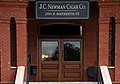 J.C. Newman cigar factory, still in operation - 2023


See also
- List of National Historic Landmarks in Florida
- National Register of Historic Places listings in Tampa, Florida
Notes
- ^ "National Register Information System". National Register of Historic Places. National Park Service. July 9, 2010.
- ^ Ybor City Historic District Archived March 23, 2009, at the Wayback Machine at National Historic Landmarks Program Archived September 27, 2007, at the Wayback Machine
- ^ "Ybor City". Oxford Dictionaries. Oxford University Press. Archived from the original on March 8, 2013. Retrieved February 7, 2013.
- ^ a b "NHL nomination for Ybor City Historic District". National Park Service. Retrieved January 21, 2018.
- ^ Visit the Museum
- ^ Latino Barrio Commission at City of Tampa website
External links
-
 Media related to
Ybor City Historic District at Wikimedia Commons
Media related to
Ybor City Historic District at Wikimedia Commons - Burgert Brothers Ybor Collection An interactive map of Ybor City where historic photos were taken by the Burgert Brothers.
- Ybor City Development Corporation
- Map of Ybor City Historic District
- Historic American Buildings Survey (HABS) No. FL-217, " Ybor City Historic District, Bounded by Fourteenth Avenue South, Fifteenth Avenue North, Twenty-first Street East & Fourteenth Street West, Tampa, Hillsborough County, FL", 1 measured drawing
- HABS No. FL-263, " Gutierrez Building, 1603 East Seventh Avenue, Tampa, Hillsborough County, FL", 3 photos, 3 measured drawings, 11 data pages, 1 photo caption page
- HABS No. FL-265, " Antonio del Rio Building, 1514, 1516, 1518 East Eighth Avenue, Tampa, Hillsborough County, FL", 3 photos, 1 color transparency, 3 measured drawings, 9 data pages, 2 photo caption pages
- HABS No. FL-266, " M. Leibovitz Building, 1818 East Seventh Avenue, Tampa, Hillsborough County, FL", 1 photo, 8 data pages
- HABS No. FL-267, " B. F. Marcos Building, 1610 East Seventh Avenue, Tampa, Hillsborough County, FL", 2 photos, 1 color transparency, 2 measured drawings, 8 data pages, 2 photo caption pages
- HABS No. FL-268, " F. Mayo Building, 1518 East Seventh Avenue, Tampa, Hillsborough County, FL", 1 photo, 1 measured drawing, 7 data pages, 1 photo caption page
- HABS No. FL-269, " Scozzari Brothers Building, 1901 East Seventh Avenue, Tampa, Hillsborough County, FL", 3 photos, 2 measured drawings, 9 data pages, 1 photo caption page
- HABS No. FL-270, " Ybor Cigar Factory, 1916 North Fourteenth Street, Tampa, Hillsborough County, FL", 32 photos, 3 color transparencies, 13 measured drawings, 24 data pages, 4 photo caption pages
- HABS No. FL-271, " Cherokee Club, 1318 Ninth Avenue, Tampa, Hillsborough County, FL", 12 photos, 7 measured drawings, 12 data pages, 1 photo caption page
- HABS No. FL-272, " Tampa Ironwork, Tampa, Hillsborough County, FL", 3 measured drawings, 3 data pages
- HABS No. FL-400, " Lozano Cigar Factory, 1410 North Twenty-first Street, Tampa, Hillsborough County, FL", 22 measured drawings

- Spanish-American culture in Tampa, Florida
- National Historic Landmarks in Florida
- Cuban-American culture in Tampa, Florida
- Historic districts on the National Register of Historic Places in Florida
- National Register of Historic Places in Tampa, Florida
- Historic American Buildings Survey in Florida
- Tobacco buildings in the United States
- National Historic Landmark Districts