| Yariguíes National Park | |
|---|---|
IUCN category II (
national park) | |
| Location | Santander Department, Colombia |
| Nearest city | Barrancabermeja |
| Coordinates | 6°33′N 73°26′W / 6.550°N 73.433°W |
| Area | 78,837 hectares (194,810 acres) |
| Website | Parques naturales de Colombia |
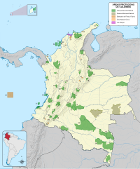
Yariguíes National Park ( Spanish: Serranía de los Yariguíes) is a natural park in north central Colombia. It is located in the Santander department and measures 78,837 hectares (194,810 acres). [1] It was officially designated as a national natural park in 2005. [2]
See also
References
- ^ Benjamin Villegas; Laura Sesana (2007). Colombia Natural Parks. Villegas Associates. p. 253. ISBN 978-958-8156-87-3. Retrieved 4 August 2011.
- ^ Office of the President (2005). "Serranía de Los Yariguíes, Nuevo Parque Nacional Natural" (in Spanish). Presidencia de la República. Retrieved 4 August 2011.


