You can help expand this article with text translated from
the corresponding article in Vietnamese. (March 2009) Click [show] for important translation instructions.
|
Yên Bình district
Huyện Yên Bình | |
|---|---|
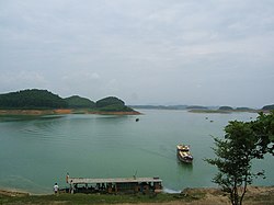
 Thác Bà Lake | |
|
Interactive map outlining Yên Bình District | |
| Coordinates: 21°45′00″N 105°04′59″E / 21.750°N 105.083°E | |
| Country | |
| Region | Northeast |
| Province | Yên Bái |
| Capital | Yên Bình |
| Subdivision | 2 townships and 22 rural communes |
| Government | |
| • Type | District |
| Area | |
| • Total | 773.20 km2 (298.53 sq mi) |
| Population (2019)
[1] | |
| • Total | 112,046 |
| • Density | 140/km2 (380/sq mi) |
| Time zone | UTC+7 (UTC + 7) |
| Website |
yenbinh |
Yên Bình is a rural district of Yên Bái province, in the Northeast region of Vietnam. As of 2019, the district had a population of 112,046. [1] The district covers an area of 773.20 km2.
Administrative divisions
Yên Bình is divided into 24 commune-level sub-divisions, including 2 townships (Yên Bình, Thác Bà) and 22 rural communes (Bạch Hà, Bảo Ái, Cảm Ân, Cảm Nhân, Đại Đồng, Đại Minh, Hán Đà, Mông Sơn, Mỹ Gia, Ngọc Chấn, Phú Thịnh, Phúc An, Phúc Ninh, Tân Hương, Tân Nguyên, Thịnh Hưng, Vĩnh Kiên, Vũ Linh, Xuân Lai, Xuân Long, Yên Bình, Yên Thành).
References
- ^ a b General Statistics Office of Vietnam (2019). "Completed Results of the 2019 Viet Nam Population and Housing Census" (PDF). Statistical Publishing House (Vietnam). ISBN 978-604-75-1532-5.
