This article has multiple issues. Please help
improve it or discuss these issues on the
talk page. (
Learn how and when to remove these template messages)
|
Wolfschlugen | |
|---|---|
 Coat of arms | |
Location of Wolfschlugen within Esslingen district 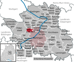 | |
 Wolfschlugen  Wolfschlugen | |
| Coordinates: 48°39′N 9°17′E / 48.650°N 9.283°E | |
| Country | Germany |
| State | Baden-Württemberg |
| Admin. region | Stuttgart |
| District | Esslingen |
| Government | |
| • Mayor (2018–26) | Matthias Ruckh [1] |
| Area | |
| • Total | 7.12 km2 (2.75 sq mi) |
| Elevation | 371 m (1,217 ft) |
| Population (2022-12-31)
[2] | |
| • Total | 6,390 |
| • Density | 900/km2 (2,300/sq mi) |
| Time zone | UTC+01:00 ( CET) |
| • Summer ( DST) | UTC+02:00 ( CEST) |
| Postal codes | 72649 |
| Dialling codes | 07022 |
| Vehicle registration | ES, NT |
| Website | wolfschlugen.de |
Wolfschlugen is a town in the district of Esslingen in the Filder Plain in Baden-Württemberg in southern Germany.
History
Wolfschlugen was first mentioned in documents on April 2, 1318 when a local named Benz from Kirchheim unter Teck sold some products of his farm in Wolfschlugen. [3] It is however commonly assumed that people have settled there long before. A strong indication is provided by the close presence of the Waldhauser Schloss, an old Latin estate in a forest nearby Wolfschlugen. [4]
- 1380 the town became official by a declaration of Eberhard II, Count of Württemberg.
- 1603 the Protestant church was reconstructed and obtained the shape which still can be seen today.
- 1608/09 construction of the town hall by the builders Michel Knell and Jerg Mercklin.
- 1776 construction of the first school.
- 1866 foundation of the voluntary fire department.
- 1899 first telegraph office.
- 1903 foundation of the music society.
- 1906 first telephone connection.
- 1914 first electrical lights on the streets.
- 1938 Wolfschlugen became a member of the district of Nürtingen.
- 1970 dedication of the festival hall and the sports field.
- 1973 the district of Nürtingen ceased to exist and the municipality Wolfschlugen was absorbed into the district of Esslingen.
- 1993 dedication of the new sports hall.
Demographics
Number of residents
The numbers of inhabitants are census results (¹) or official data from statistical office, Stuttgart.
|
References
Wikivoyage has a travel guide for
Wolfschlugen.
- ^ "Bürgermeisterwahl Wolfschlugen 2018". Staatsanzeiger BW (in German). Retrieved 5 June 2023.
- ^ "Bevölkerung nach Nationalität und Geschlecht am 31. Dezember 2022" [Population by nationality and sex as of December 31, 2022] (CSV) (in German). Statistisches Landesamt Baden-Württemberg. June 2023.
- ^ "Wolfschlugen - Geschichte". www.wolfschlugen.de. Archived from the original on 2002-08-09.
- ^ "Waldhauser Schloss (Neuhausen auf den Fildern)". Vici.org. 2013-05-28. Retrieved 2022-12-20.
| International | |
|---|---|
| National | |
|
| This Esslingen district location article is a stub. You can help Wikipedia by expanding it. |