State Trunk Highway 162 | ||||
|---|---|---|---|---|
WIS 162 highlighted in red | ||||
| Route information | ||||
| Maintained by WisDOT | ||||
| Length | 46.03 mi [1] (74.08 km) | |||
| Major junctions | ||||
| South end | ||||
| ||||
| North end | ||||
| Location | ||||
| Country | United States | |||
| State | Wisconsin | |||
| Counties | Vernon, La Crosse, Monroe | |||
| Highway system | ||||
| ||||

State Trunk Highway 162 (often called Highway 162, STH-162 or WIS 162) is a state highway in the U.S. state of Wisconsin. It runs in north–south in southwest Wisconsin from Stoddard to Four Corners.
Route description
The highway starts at its intersection with WIS 33 and Division Street in Stoddard and runs east along Coon Creek. After a running concurrently with County Trunk Highway K (CTH-K), the highway goes through Chaseburg and continues northeast. The highway runs along a short concurrency with US Highway 14 (US 14) and US 61. This short concurrency is a wrong-way concurrency because WIS 162 and US 61 are signed in opposing directions throughout its length. Just west of Coon Valley, the wrong-way concurrency ends as the highway runs north from it. [2]
After 6.6 miles (10.6 km), the highway runs concurrently with WIS 33, which ends at Middle Ridge. After its intersection with CTH-JB, the highway runs along Dutch Creek. It intersects Interstate 90 (I-90) before entering Bangor. After a short concurrency with CTH-B, the highway runs north from Bangor. It runs concurrently with WIS 16 before following Burns Creek. From the creek's end, the highway continues north until it terminates at WIS 71 in Four Corners. [2]
-
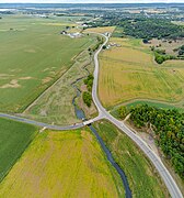
 Southwestern terminus
 -
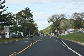
 WIS 162 near Bangor and I-90
 -
 Northern terminus


Major intersections
| County | Location | mi [2] | km | Destinations | Notes |
|---|---|---|---|---|---|
| Vernon | Stoddard | 0.0 | 0.0 | ||
| Bergen | 0.7 | 1.1 | |||
| Hamburg | 6.7 | 10.8 | Northern end of CTH-K concurrency | ||
| Chaseburg | 7.6 | 12.2 | Southern end of CTH-K concurrency | ||
| Hamburg | 12.4 | 20.0 | Western end of US 14/US 61 concurrency | ||
| Coon | 13.2 | 21.2 | Eastern end of US 14/US 61 concurrency | ||
| La Crosse | Washington | 19.8 | 31.9 | Western end of WIS 33 concurrency | |
| 20.3 | 32.7 | ||||
| 22.8 | 36.7 | Eastern end of WIS 33 concurrency | |||
| Bangor (town)– Bangor line | 29.9 | 48.1 | |||
| 30.2 | 48.6 | Western end of CTH-B concurrency | |||
| Bangor | 30.6 | 49.2 | Eastern end of CTH-B concurrency | ||
| Burns | 32.2 | 51.8 | Eastern end of WIS 16 concurrency | ||
| 32.7 | 52.6 | Western end of WIS 16 concurrency | |||
| 35.3 | 56.8 | ||||
| 41.8 | 67.3 | ||||
| 43.2 | 69.5 | ||||
| Monroe | Little Falls | 45.4 | 73.1 | ||
1.000 mi = 1.609 km; 1.000 km = 0.621 mi
| |||||
See also
References
- ^ Bessert, Christopher J. "Highways 160–169". Wisconsin Highways. Retrieved 2007-03-20.
- ^ a b c Google (April 4, 2020). "Length and Route of WIS 162" (Map). Google Maps. Google. Retrieved April 4, 2020.
External links
-
 Media related to
Wisconsin Highway 162 at Wikimedia Commons
Media related to
Wisconsin Highway 162 at Wikimedia Commons