(Redirected from
Willow River (Tomahawk River))
| Willow River | |
|---|---|
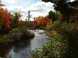
 Willow River near the rapids. | |
| Physical characteristics | |
| Source | |
| • coordinates | 45°48′33″N 89°04′03″W / 45.809121°N 89.067376°W |
| Mouth | |
• coordinates | 45°42′06″N 89°56′29″W / 45.7016236°N 89.941260°W |
• elevation | 1,526 feet (465 m) |
The Willow River is a river in Oneida County, Wisconsin, that merges with the Tomahawk River by way of the Willow Flowage. Historically the Willow River was a significant white pine logging region. [1]
References
- ^ "Town of Lynne, Oneida County, WI". Retrieved September 21, 2014.
External links
U.S. Geological Survey Geographic Names Information System: Willow River (Tomahawk River tributary)