| This page is an archive. Do not edit the contents of this page. Please direct any additional comments to the current main page. |
This page lists all completed shield discussions. Failed proposals should have "(Failed)" appended to their title.
Queensland A routes and ALT A2 integration into AUshield
There isn't any A71 AUshield, but there is
![]() . In fact, I prefer this to be the standard for the AUshield for alpha numeric in non NSW and ACT states.
Marcnut1996 (
talk) 12:28, 16 June 2013 (UTC)
. In fact, I prefer this to be the standard for the AUshield for alpha numeric in non NSW and ACT states.
Marcnut1996 (
talk) 12:28, 16 June 2013 (UTC)
Just to be clear, you need a NSW A71? -- Definately agreed on the non-NSW alphas though, the old QLD set is the closest to preferred (mainly because it doesnt have a space between the letters!) -- Nbound ( talk) 12:31, 16 June 2013 (UTC)
- After looking into the route (thinking it was odd for an A route to be above 50). We need the QLD A71 added to AUshield... I will do this now. --
Nbound (
talk) 12:40, 16 June 2013 (UTC)
- Nope, the QLD A71 (there is no A71 in NSW). In addition what is the AUshield code for
 ?
Marcnut1996 (
talk) 12:44, 16 June 2013 (UTC)
?
Marcnut1996 (
talk) 12:44, 16 June 2013 (UTC)
- Nope, the QLD A71 (there is no A71 in NSW). In addition what is the AUshield code for
- After looking into the route (thinking it was odd for an A route to be above 50). We need the QLD A71 added to AUshield... I will do this now. --
Nbound (
talk) 12:40, 16 June 2013 (UTC)
{{AUshield|QA|71}}produces
{{AUshield|QA|ALTA2}}produces
Note: This requires some fugly code, cant wait till these shield are redone :D -- Nbound ( talk)
NSW/ACT Alphanumeric Shields
Id like to propose we stop using the alphanumeric shields provided by Bidgee as can be seen here on Wikimedia Commons. And replace them with something closer to what actually appears on the signs:
or
(images source:
http://expressway.paulrands.com/ )
The source website has images like what i would prefer:
here.
Bidgee's images are based off the promotional ones used on the RMS website
here
Thoughts/issues? -- Nbound ( talk) 01:46, 27 April 2013 (UTC)
If agreed, it would then be good to add the new images to the AU shield generator template. - Nbound ( talk)
- I agree that the images should be as close to the actual usage as possible, or at the very least be consistent across the whole set of NSW/ACT alphanumeric routes (one reason why I haven't added them to the {{
AUshield}} template). I did raise the issue previously at WP:AUS, it is now
archived here. A quick summary would be:
- The routes needed are:
- M1 M2 M4 M5 M7 M23 M31 A1 A2 A3 A4 A6 A8 A9 A15 A20 A22 A23 A25 A28 A32 A34 A36 A37 A38 A39 A40 A41 A43 A44 A49 B23 B51 B52 B53 B55 B56 B57 B58 B59 B60 B62 B63 B64 B65 B69 B70 B71 B72 B73 B74 B75 B76 B78 B79 B81 B83 B84 B85 B87 B88 B91 B94 B95
- It would be desirable to create a "full range" including routes not yet planned to be used so that we're ready for future route upgrades or additional routes
- The outside green border is actually part of the sign, not the shield. However, including such a border allows the white outline to show up against a white/light coloured background
- Official documentation/standards on the dimensions (such as this for US interstates) has not been found
- Vector graphics (SVG) should be used rather than raster graphics (PNG)
- The commons:User:Highway Route Marker Bot will be able to make all the shields we need, if we can provide it with an example svg template, and a font to use
- -
Evad37 (
talk) 02:27, 27 April 2013 (UTC)
- The font is available from roadgeek sources IIRC. - Nbound ( talk) 09:00, 27 April 2013 (UTC)
- Theres a few available but Im not sure which is it (ill knock up a few in the coming days when I get time - or someone can beat me to it?).
- I agree we should keep the green beyond the border, we may even decide to eventually put "sign green" sections at the top of RJLs or infoboxes.
- We dont need official standards (though it would be nice), we should just be able to get the specs from the trace of a half decent photo (the shields themselves are likely to simple to be covered by copyright anyway).
- Vector graphics should be used whenever possible, even beyond this particular discussion, so agreed there.
Nbound ( talk) 12:27, 27 April 2013 (UTC)
- Im unable to get the font looking right, anyone else want to give it a shot? -
Nbound (
talk) 23:36, 30 April 2013 (UTC)
- I can look at it. Is there a standard drawing out there for the big green signs? That may give us a clue for what proportions we need. –
Fredddie
™ 23:41, 30 April 2013 (UTC)
- And honestly, once we get the proportions figured out, I can have them done and uploaded within an hour. MUCH faster than HRMB. –
Fredddie
™ 23:42, 30 April 2013 (UTC)
- There are no standard drawings available yet. Only pictures of real life installations. The pictures at the top of this thread have both the 2 and 3 character versions, and you can likely find closer version on the same site (Note: These images are copyrighted, though I doubt using them for approximate sizing is affected). There are images onsite which they have made themselves, which are likely too simple to be eligible for copyright (eg.
http://expressway.paulrands.com/images/routenumbers/nswalphas/m31.png - though the two character version has incorrect sizing, and the outer white area would preferably be an alpha channel, it also would be much preferred to be an SVG render) -
Nbound (
talk) 00:04, 1 May 2013 (UTC)
- If you are unfamiliar with Australian Highways, I can try and find better example pictures. Just let me know -
Nbound (
talk)
- Actually, there are these photos
[1]
[2] of drawings for specific signs, which someone apparently found stuck on the rear of a couple of signs. The image quality isn't great, but you might be able to make out the numbers (of course, those are only the proportions for two digit alphanumeric routes). And there are galleries with many photos on that website:
[3] and
[4] -
Evad37 (
talk) 00:31, 1 May 2013 (UTC)
- Very nice! Well, I worked
this out, so let me refactor now that we have some measurements. –
Fredddie
™ 00:40, 1 May 2013 (UTC)
- How's this? [5] – Fredddie ™ 01:01, 1 May 2013 (UTC)
- Great find Evad, i had been browsing official papers for some time looking for just that. It might just be me but the white border looks a little too big, compare its size to the width of the 1. -
Nbound (
talk) 01:04, 1 May 2013 (UTC)
- Hrm. I read the height of the sign was 320mm and inside the border measured 247mm. That makes it a 36.5mm border. The font is standard FHWA Series D. Since there was no measurement for the height of the letters, I took a ruler and found that it was half the height of the outer border. That's great because numbers are half as tall as the sign is a standard here in the US. It could just be an illusion since we're just looking at the number plate and not the whole sign. –
Fredddie
™ 01:26, 1 May 2013 (UTC)
- Is 247 the inside height, or just the height of the arrow next to it? It looks to me that the border width is (approximately) the same width as the leg of the "1" -
Evad37 (
talk) 01:43, 1 May 2013 (UTC)
- I would imagine the route marker would have its own subtemplate, and that this is just providing the dimensions that said subtemplate is to be sized as in this instance. It would make sense for the arrow (presumably its own subtemplate, to have its own measurement aswell. It can also be seen that there is no measurement on the bottom axis for the letters, further suggesting that its for the arrow, which does have its own measurements on the bottom axis. - Nbound ( talk) 01:50, 1 May 2013 (UTC)
- Is 247 the inside height, or just the height of the arrow next to it? It looks to me that the border width is (approximately) the same width as the leg of the "1" -
Evad37 (
talk) 01:43, 1 May 2013 (UTC)
- Hrm. I read the height of the sign was 320mm and inside the border measured 247mm. That makes it a 36.5mm border. The font is standard FHWA Series D. Since there was no measurement for the height of the letters, I took a ruler and found that it was half the height of the outer border. That's great because numbers are half as tall as the sign is a standard here in the US. It could just be an illusion since we're just looking at the number plate and not the whole sign. –
Fredddie
™ 01:26, 1 May 2013 (UTC)
- Very nice! Well, I worked
this out, so let me refactor now that we have some measurements. –
Fredddie
™ 00:40, 1 May 2013 (UTC)
- Actually, there are these photos
[1]
[2] of drawings for specific signs, which someone apparently found stuck on the rear of a couple of signs. The image quality isn't great, but you might be able to make out the numbers (of course, those are only the proportions for two digit alphanumeric routes). And there are galleries with many photos on that website:
[3] and
[4] -
Evad37 (
talk) 00:31, 1 May 2013 (UTC)
- If you are unfamiliar with Australian Highways, I can try and find better example pictures. Just let me know -
Nbound (
talk)
- There are no standard drawings available yet. Only pictures of real life installations. The pictures at the top of this thread have both the 2 and 3 character versions, and you can likely find closer version on the same site (Note: These images are copyrighted, though I doubt using them for approximate sizing is affected). There are images onsite which they have made themselves, which are likely too simple to be eligible for copyright (eg.
http://expressway.paulrands.com/images/routenumbers/nswalphas/m31.png - though the two character version has incorrect sizing, and the outer white area would preferably be an alpha channel, it also would be much preferred to be an SVG render) -
Nbound (
talk) 00:04, 1 May 2013 (UTC)
- And honestly, once we get the proportions figured out, I can have them done and uploaded within an hour. MUCH faster than HRMB. –
Fredddie
™ 23:42, 30 April 2013 (UTC)
- I can look at it. Is there a standard drawing out there for the big green signs? That may give us a clue for what proportions we need. –
Fredddie
™ 23:41, 30 April 2013 (UTC)
- Im unable to get the font looking right, anyone else want to give it a shot? -
Nbound (
talk) 23:36, 30 April 2013 (UTC)
![[1]](http://www.ozroads.com.au/NSW/Special/MAB/289.jpg)
![[2]](http://www.ozroads.com.au/NSW/Special/MAB/285.jpg)
![[5]](http://img541.imageshack.us/img541/8452/b81.png)
If you look carefully, one of the drawings says the border is 24x24, which I am guessing the white border is 24mm and the edge to the white border measures 24mm. I'll recalculate and repost. – Fredddie ™ 03:57, 1 May 2013 (UTC)
- [6] – Fredddie ™ 04:01, 1 May 2013 (UTC)
- Looks pretty good to me :) -
Nbound (
talk)
- OK, I will start making them soon. What file nomenclature would you like me to use? –
Fredddie
™ 04:17, 1 May 2013 (UTC)
- Something like "NSW alphanumeric route <route>.<extension>"... or for your pre-existing example: "NSW alphanumeric route B81.<extension>". Will the final results be SVG or PNG as your test uploads so far have been (SVG would be preferred for ease of future editing). A blank shield for both 2 and 3 character sized shield would be nice too. -
Nbound (
talk) 04:29, 1 May 2013 (UTC)
- SVG definitely. Inkscape lets me export to PNG, which is faster and easier for uploading to Imageshack. Will do blanks as well. –
Fredddie
™ 04:32, 1 May 2013 (UTC)
- Great, thanks for helping us out! -
Nbound (
talk) 04:36, 1 May 2013 (UTC)
 Done
commons:Category:Diagrams of New South Wales alphanumeric route markers –
Fredddie
™ 05:09, 1 May 2013 (UTC)
Done
commons:Category:Diagrams of New South Wales alphanumeric route markers –
Fredddie
™ 05:09, 1 May 2013 (UTC)
-
 Added to {{
AUshield}}:
Added to {{
AUshield}}: 


 -
Evad37 (
talk) 05:34, 1 May 2013 (UTC)
-
Evad37 (
talk) 05:34, 1 May 2013 (UTC)
- M1 and A1 are bigger than the other 2 character markers, is this meant to be the case? (I havent seen enough in the flesh yet to be sure). Regardless, good work, I like them :) -
Nbound (
talk) 05:39, 1 May 2013 (UTC)
- We'll need an M15 one for the Hunter Expressway, though unless you are feeling generous Fredddie, we can knock that one up when required.
- All the shields with a 1 in them look bigger than other shields.... -
Nbound (
talk) 05:43, 1 May 2013 (UTC)
- That's because I removed the extra green space around the number, but if you look at the files, they are all the same height (or should be). So, if you put them all in a row at the same height (as seen in the
{{
AUshield}}
example above), they will all be the same height. – Fredddie ™ 05:48, 1 May 2013 (UTC)- Compare


 (M15 is widened by me as it was missing anyway), as far as I am aware, there are only two sizes. But others may have information otherwise -
Nbound (
talk) 06:00, 1 May 2013 (UTC)
(M15 is widened by me as it was missing anyway), as far as I am aware, there are only two sizes. But others may have information otherwise -
Nbound (
talk) 06:00, 1 May 2013 (UTC)
- Further digging shows you are correct so disregard above: http://www.ozroads.com.au/NSW/Special/MAB/388.jpg - Nbound ( talk) 06:02, 1 May 2013 (UTC)
- M15 now normal size -
Nbound (
talk)
- Good thinking with the separate ACT selection (which is atm coded as if NSW was typed), never know if one day the ACT will go out on its own and stuff things up, so will save time if we all use the ACT prefix if the part of road or junction in question is within the ACT --
Nbound (
talk) 06:18, 1 May 2013 (UTC)
- I am going to update the files I uploaded last night because of the color specifications posted below. I originally used the green and yellow colors from the US MUTCD, but now that I know the values for Australia, it's a simple find-and-replace. –
Fredddie
™ 16:18, 1 May 2013 (UTC)
- Good work on the state shields, what reason was there for the reversions previously anyway - the colours are clearly wrong compare to every one Ive seen or seen photos of? Is this how we ended up with a "Queensland State Shield" in AUshield? -
Nbound (
talk) 21:46, 1 May 2013 (UTC)
- See commons:User_talk:Bidgee/Archive11#Route_Shields regarding the previous reversions. The reason {{ AUshield}} had a separate Queensland State Shield is that I coded the template the last year, I based it on how images were being used in the articles. The shields were created way before I started editing Wikipedia: the light-blue SVGs date back to 2006, while the PNGs used in QLD articles date back to 2007. - Evad37 ( talk) 08:42, 2 May 2013 (UTC)
- Good work on the state shields, what reason was there for the reversions previously anyway - the colours are clearly wrong compare to every one Ive seen or seen photos of? Is this how we ended up with a "Queensland State Shield" in AUshield? -
Nbound (
talk) 21:46, 1 May 2013 (UTC)
- I am going to update the files I uploaded last night because of the color specifications posted below. I originally used the green and yellow colors from the US MUTCD, but now that I know the values for Australia, it's a simple find-and-replace. –
Fredddie
™ 16:18, 1 May 2013 (UTC)
- Good thinking with the separate ACT selection (which is atm coded as if NSW was typed), never know if one day the ACT will go out on its own and stuff things up, so will save time if we all use the ACT prefix if the part of road or junction in question is within the ACT --
Nbound (
talk) 06:18, 1 May 2013 (UTC)
- Compare
- That's because I removed the extra green space around the number, but if you look at the files, they are all the same height (or should be). So, if you put them all in a row at the same height (as seen in the
- M1 and A1 are bigger than the other 2 character markers, is this meant to be the case? (I havent seen enough in the flesh yet to be sure). Regardless, good work, I like them :) -
Nbound (
talk) 05:39, 1 May 2013 (UTC)
-
- Great, thanks for helping us out! -
Nbound (
talk) 04:36, 1 May 2013 (UTC)
- SVG definitely. Inkscape lets me export to PNG, which is faster and easier for uploading to Imageshack. Will do blanks as well. –
Fredddie
™ 04:32, 1 May 2013 (UTC)
- Something like "NSW alphanumeric route <route>.<extension>"... or for your pre-existing example: "NSW alphanumeric route B81.<extension>". Will the final results be SVG or PNG as your test uploads so far have been (SVG would be preferred for ease of future editing). A blank shield for both 2 and 3 character sized shield would be nice too. -
Nbound (
talk) 04:29, 1 May 2013 (UTC)
- OK, I will start making them soon. What file nomenclature would you like me to use? –
Fredddie
™ 04:17, 1 May 2013 (UTC)
![[6]](http://imageshack.us/a/img841/6849/b812.png)
State Routes
While were redoing shields, can we take a look at the state shields? They were actually (mostly) updated by Outrune to a more accurate version last year, but that was quickly reverted - see example file history. You could also start from scratch, as it is basically the same design as a US interstate shield, but without the top part that says INTERSTATE. 1, 2, and 3 digit routes all use the same size shield, with the text size adjusted. The routes required (based off what is currently uploaded to commons) are:
- Single digit: 1 to 9
- Two digits: 10 to 99
- Three digits: 100, 102, 104, 106, 107, 111, 112, 115, 116, 120, 121, 122, 123, 124, 128, 130, 131, 132, 133, 135, 136, 138, 141, 149, 151, 153, 155, 156, 157, 168, 174, 180, 181, 182, 186, 188, 191, 195
I will have a look around to see if there are any standards drawings to show number height or font - Evad37 ( talk) 01:43, 1 May 2013 (UTC)
- Haven't found anything usable yet, at least not freely available. The road authorities websites I've tried all point to Australian Standards
AS1742 and/or
AS1743, which are very expensive. -
Evad37 (
talk) 02:54, 1 May 2013 (UTC)
- I did find it for
considerably less. –
Fredddie
™ 03:46, 1 May 2013 (UTC)
- NSW has some basic specs here: http://www.rta.nsw.gov.au/cgi-bin/index.cgi?fuseaction=trafficsigns.show&id=g8/g8-8
- I did find it for
considerably less. –
Fredddie
™ 03:46, 1 May 2013 (UTC)
By the way, colours specified by the standard are defined as
- Red — Colour R13 Signal Red
- #BA312B
- Yellow — Colour Y15 Sunflower
- #FFA709
- Brown — Colour X65 Dark Brown
- #4F372D
- Blue — Colour B23 Bright Blue
- #174F90
- Standard Green — Colour G12 Holly Green
- #336745
- Green — Colour G13 Emerald
- #195F35
You can the corresponding rgb/html values from this company's website - Evad37 ( talk) 15:31, 1 May 2013 (UTC)
- Done
commons:Category:Diagrams of Australian state route markers –
Fredddie
™ 15:59, 1 May 2013 (UTC)
![]() Done Added to
Done Added to {{
AUshield}} - ![]()
![]()
![]()
Usage:
{{AUshield|SR|<route number>}}
I have left both S and QS for the time being, but it might be worth switching the output of both to SR. Docs have been updated to add SR, with and additional strikethrough across S and QS. --
Nbound (
talk) 01:12, 2 May 2013 (UTC)
- I have updated the code so that S, QS, and SR all output the new design - there is no point in encouraging the use of the old, inaccurate designs. If there was a real need to use them (which I can't imagine), they can could always be inserted into articles manually. - Evad37 ( talk) 02:27, 2 May 2013 (UTC)
ACT tourist routes
The ACT ones could do with correct font, and possibly work on the proportions (seems pretty close though). Examples: TD5 (Solid Border Type) TD4 (Fancy Border Type) Nbound ( talk) 11:50, 3 May 2013 (UTC)
- Found the colour specifications here [7] (page 30):
| Drive | Vinyl Colour | ECF Colour | Numeral Colour | RGB |
|---|---|---|---|---|
| 1 | Satin Gold | No Equivalent | Black | #726038
|
| 2 | Burgundy | No Equivalent | White | #561511
|
| 3 | Peacock Blue | No Equivalent | #5A99E0
| |
| 4 | Royal Purple | Violet 1170-13 | White | #391D50
|
| 5 | Bright orange | Orange 1174 | Black | #F64F01
|
| 6 | Satin Aluminium | No Equivalent | Black | #7C838D
|
| 7 | Sunflower | Yellow 1171 | #FDC800
|
- Evad37 ( talk) 15:10, 3 May 2013 (UTC)
- The text colour section of the table is incorrect. White on sunflower, or white on light blue... TAMS has done it again... haha -- Nbound ( talk) 15:17, 3 May 2013 (UTC)
-
TD3 Black on Blue -
Nbound (
talk)
- Turns out they did stuff it up the way it is in the table at one stage!
TD3 WHITE on Blue
- Corrected in above table -
Evad37 (
talk)
- Thanks :) -
Nbound (
talk)
- and added rgb codes for them, based a PDF catalogue of vinyl colour samples from
[8] -
Evad37 (
talk) 16:29, 3 May 2013 (UTC)
- Satin Alumininum is too dark
TD6
TD6(2). I had based mine off an actual white one I'd seen, but ill go with the lighter satin aluminium. All the rest of your colours appear to be good improvements. -
Nbound (
talk) 22:29, 3 May 2013 (UTC)
- I agree that Satin Aluminium looks too dark. Should the new files be square with a pentagon overlaid (like the pictures Nbound posted the next line up) or just the pentagon? –
Fredddie
™ 22:50, 3 May 2013 (UTC)
- Both are used, the pentagon type is the one used on most signage, the other one is just used on trailblazers, I would prefer the pentagon type. --
Nbound (
talk) 23:03, 3 May 2013 (UTC)
- I did a search for Satin Aluminium (interestingly aluminum and aluminium gave me vastly different results) and I kinda like this color: #eef1f3. It is 25% lighter than " Volkswagen Satin Silver". – Fredddie ™ 23:26, 3 May 2013 (UTC)
- Both are used, the pentagon type is the one used on most signage, the other one is just used on trailblazers, I would prefer the pentagon type. --
Nbound (
talk) 23:03, 3 May 2013 (UTC)
- I agree that Satin Aluminium looks too dark. Should the new files be square with a pentagon overlaid (like the pictures Nbound posted the next line up) or just the pentagon? –
Fredddie
™ 22:50, 3 May 2013 (UTC)
- Satin Alumininum is too dark
TD6
TD6(2). I had based mine off an actual white one I'd seen, but ill go with the lighter satin aluminium. All the rest of your colours appear to be good improvements. -
Nbound (
talk) 22:29, 3 May 2013 (UTC)
- and added rgb codes for them, based a PDF catalogue of vinyl colour samples from
[8] -
Evad37 (
talk) 16:29, 3 May 2013 (UTC)
- Thanks :) -
Nbound (
talk)
- Corrected in above table -
Evad37 (
talk)
- Turns out they did stuff it up the way it is in the table at one stage!
TD3 WHITE on Blue
According to
[9] (p4), the colours are "3M Scotchcal" Colours:
SHEETING COLOUR / COLOUR NUMBER
- Black / 12
- Satin Gold / 131
- Burgundy / 58
- Peacock Blue / 77
- Royal Purple / 38
- Bright Orange / 14
- Satin Aluminium / 120
- White is as per AS1743 (retroflective)
- The only conversion I have found so far isnt accurate to real life examples. But someone familiar with the Scotchcal colourset may have a better idea. - Nbound ( talk) 03:31, 27 May 2013 (UTC)
- OK. After a little break, I have these done and ready to upload. The ones Nbound created are here on ENWP, so I will upload the new ones to Commons and then tag the old files to be deleted under
WP:CSD#F8. I'll give Nbound all the proper credit due and all that fun stuff, too. –
Fredddie
™ 22:04, 1 June 2013 (UTC)
- Category:ACT Tourist Drive shields – Fredddie ™ 22:18, 1 June 2013 (UTC)
- OK. After a little break, I have these done and ready to upload. The ones Nbound created are here on ENWP, so I will upload the new ones to Commons and then tag the old files to be deleted under
WP:CSD#F8. I'll give Nbound all the proper credit due and all that fun stuff, too. –
Fredddie
™ 22:04, 1 June 2013 (UTC)
Old Business National Routes
- 1, 15
Usage:
{{AUshield|R|BUS1}}
Default size:
File:Australian national route BUS1.svg
File:Australian national route BUS15.svg
Bigger:
File:Australian national route BUS1.svg
File:Australian national route BUS15.svg
Infobox example usage:
File:Australian national route BUS1.svg Foobar Highway (Business National Route 1)
At this size (18px) the shield is approx equal to a standard national route, as seen here:
File:Australian national route BUS1.svg![]()
![]()
- By default,
{{ AUshield}}will now size the images to be the same size as a standard route marker (the actual value was17px) - Evad37 ( talk) 12:59, 8 May 2013 (UTC)
Old Sydney Freeway Routes
Imagery: B+W closeup Approx colouring F6 Colour closeup
- F1-F8
Usage:
{{AUshield|Syd|F3}}
Infobox example usage:
Southern Freeway (F6)
- Question about these. Did you use a template for an
interstate sign or was this made new? –
Fredddie
™ 01:25, 6 May 2013 (UTC)
- Made new by approximating the "Colour closeup" image (colours used where the State Route Blue, and ACT Tourist Drive Orange). The shield is very similar to US interstate routes, possibly even borrowed from the US by the NSW Govt.--
Nbound (
talk) 01:29, 6 May 2013 (UTC)
- Direct link to one of my shields if curious - F3 Freeway shield - Nbound ( talk) 01:33, 6 May 2013 (UTC)
- Made new by approximating the "Colour closeup" image (colours used where the State Route Blue, and ACT Tourist Drive Orange). The shield is very similar to US interstate routes, possibly even borrowed from the US by the NSW Govt.--
Nbound (
talk) 01:29, 6 May 2013 (UTC)
- Removed empty space around borders, may take upto a few hours for shield thumbs to update. - Nbound ( talk) 03:24, 6 May 2013 (UTC)
Old Sydney Ring Roads
Imagery: front on Approx sizing (there is a different variation of these but the smaller one is the easiest to create)
- 1, 3, 5
Usage:
{{AUshield|SydRR|3}}
Infobox example usage: Foobar Highway (Ring Road 1)
Alternative State Routes
- ALT10, ALT30
Proposed usage:
{{AUshield|S|ALT10}} (ie. as with current state routes)
- Alternate state routes just use an alt plate, such as File:Alt plate blue.svg above the state route shield. The two can be combined using code - I know {{ jct}} does this for bannered routes in the U.S. I've managed to do this as below:
- I should be able to code this into {{
AUshield}}, though getting it to scale correctly at different sizes could be tricky -
Evad37 (
talk) 03:04, 6 May 2013 (UTC)
- Fair enough, is this how we should have implemented the Alt Nat Routes? (but with a white version), Therese several different versions and im fairly sure ive seen ALT signs with the separate coverplate. -
Nbound (
talk) 03:10, 6 May 2013 (UTC)
- The Australian Standard shows that the alt plate is actually integrated for national routes and highways (contained within the outline), whereas for state routes it is a separate plate that sits ontop of the marker. Whether states and territories actually follow the standard is another matter altogether. - Evad37 ( talk) 03:19, 6 May 2013 (UTC)
- Fair enough, is this how we should have implemented the Alt Nat Routes? (but with a white version), Therese several different versions and im fairly sure ive seen ALT signs with the separate coverplate. -
Nbound (
talk) 03:10, 6 May 2013 (UTC)
I've made some changes in {{ AUshield/sandbox}}, but it only works at the default size, requires extra parameters, and the vertical alignment of the text isn't quite right:
 Alternate State Route 30


 Example text


 Example text
It might be easier to just create complete images of the shields with ALT plates, or code them by hand as I did above - Evad37 ( talk) 02:07, 8 May 2013 (UTC)
- It probably would be easier just to make the shields whole, saves the other issues, and both images are PD and just need to be stitched together... I will create these later if you want (or you can now, dont mind); Do we need an ALT SR30 one or just ALTSR 10? -
Nbound (
talk) 03:02, 8 May 2013 (UTC)
- Definitely also need ALT30, that's actually a current route - Evad37 ( talk) 03:09, 8 May 2013 (UTC)
- It probably would be easier just to make the shields whole, saves the other issues, and both images are PD and just need to be stitched together... I will create these later if you want (or you can now, dont mind); Do we need an ALT SR30 one or just ALTSR 10? -
Nbound (
talk) 03:02, 8 May 2013 (UTC)
Usage:
{{AUshield|S|ALT10}}
Infobox example usage:
File:Australian state route ALT10.svg Foobar Highway (Alternate State Route 10)
File:Australian state route ALT10.svg![]()
File:Australian state route ALT10.svg
Equivalency to standard icons is achieved at approx size 22px.
File:Australian state route ALT10.svg![]()
- By default,
{{
AUshield}}
will now size the images to be the same size as a standard route marker (the actual value was21px) - Evad37 ( talk) 12:59, 8 May 2013 (UTC)
Old Melbourne Ring Roads
- Unknown, presumably at least Ring Road 80
Usage:
{{AUshield|MelRR|80}}
Infobox example usage: Foobar Highway (Ring Road 80)
Territory variant National Highway Route shields
ACT example 23, ACT example 25, NT example 1, NT example 66/87
- 1, 23, 25, 66, 87
Proposed usage:
{{AUshield|ACTN|23}} and {{AUshield|NTN|87}}
Alternative proposed usages:
{{AUshield|TN|23}} or {{AUshield|TerN|23}}
It should be noted that in both the ACT and NT, numerous examples of standard national highway signs also exist. While we have found documentation officially supporting these signs use in the ACT. None has been found for the NT, yet.
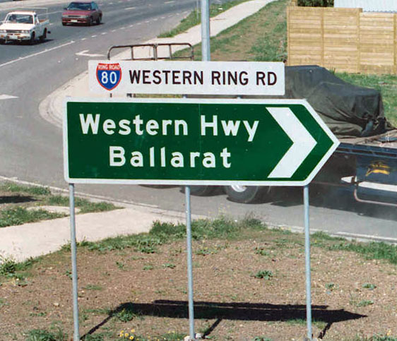
Note: I've oddly found one of these for the Western Highway in Victoria... is it related in some way? (the design isnt quite the same) -- Nbound ( talk) 14:31, 5 May 2013 (UTC)
Usage:
{{AUshield|ACTN|23}} or preferably {{AUshield|TerN|87}} once status in NT is verified.
Infobox example usage: Foobar Highway (National Highway 23)
Old Alternative National Routes
- 20, 31, 39, 79
Usage:
{{AUshield|R|ALT20}}
Infobox example usage: ![]() Foobar Highway (Alternate National Highway 20)
Foobar Highway (Alternate National Highway 20)
![]() File:Australian national route ALT31.svg
File:Australian national route ALT31.svg![]()
![]()
File:Australian national route ALT31.svg
Pre "Interstate-style" Freeway Routes (Request withdrawn)
Imagery:
[10]
![[10]](http://www.ozroads.com.au/NSW/RouteNumbering/Freeway%20Routes/09.JPG)
- F1-8 (but only a subset of these would be used - if anyone specifically knows which, that would be great)
Proposed usage:{{AUshield|Syd|OldF1}}
- [11]. In this page, it seems AUshield one is used in road signs, while a particular white shield [12] is used in a Gregory Maxi Street Directory 1987. Marcnut1996 ( talk) 12:36, 3 June 2013 (UTC)
![[12]](http://ozroads.com.au/NSW/RouteNumbering/Freeway%20Routes/10.JPG)
Note: Withdrawn by Nbound on 8 July 2013 with edit summary "withdrawing request - im now unconvinced these werent just a variant"
Non-NSW Alphanumeric routes
Just starting a new section here, noting that these should also be redone. About half of them are currently PNGs, and lettering, spacing, colours vary between them. - Evad37 ( talk) 02:45, 3 May 2013 (UTC)
- Would these be in the same style as the NSW alphanumerics? –
Fredddie
™ 02:57, 3 May 2013 (UTC)
- Similar, but without the white outline, and I think the font series varies with the number of digits, as per the national highway shields. I'll see if I can find any specs. -
Evad37 (
talk) 03:04, 3 May 2013 (UTC)
- Or they might use the same font for each route number, based on some of the photos I've looked at, eg
[13]
- The QLD document linked above ( [14]) has the font as series E (page 56). There is no specific guidance on spacing required around around the text - maybe measure the (inside) spacing dimensions from Figure 4.3 G8-11-2 (free standing reassurance marker) on page 59?
- Or they might use the same font for each route number, based on some of the photos I've looked at, eg
[13]
- Similar, but without the white outline, and I think the font series varies with the number of digits, as per the national highway shields. I'll see if I can find any specs. -
Evad37 (
talk) 03:04, 3 May 2013 (UTC)
![[13]](http://expressway.paulrands.com/gallery/roads/vic/numbered/alphanumeric/m80/02_tullamarinetogreensborough/anticlockwise/images/200602_09_glenroy_robtilley.jpg)
M routes: 1, 2, 3, 4, 5, 7, 11, 79, 80, 420, 780
A routes: 1, 2, 2 (ALT)1, 3, 4, 5, 6, 7, 8, 9, 10, 11, 12, 13, 14, 15, 16, 17, 18, 19, 20, 21, 22, 32, 52, 55, 66, 71, 79, 87, 200, 300, 420, 440, 780, 790
B routes: 1, 6, 7, 8, 10, 11, 12, 14, 15, 16, 17, 18, 19, 20, 21, 23, 24, 27, 28, 31, 32, 33, 34, 35, 36, 37, 41, 42, 45, 51, 52, 53, 54, 55, 56, 57, 61, 62, 63, 64, 66, 68, 71, 72, 73, 75, 79, 80, 81, 82, 83, 84, 85, 86, 90, 91, 96, 100, 101, 110, 120, 140, 160, 180, 200, 201, 210, 220, 240, 260, 280, 300, 320, 324, 326, 327, 340, 360, 380, 400, 410, 420, 460, 500
C routes: 1, 2, 4, 5, 9, 12, 14, 16, 24, 80, 101, 102, 103, 104, 108, 109, 111, 114, 115, 118, 123, 124, 126, 127, 129, 136, 137, 138, 141, 142, 143, 144, 145, 146, 148, 156, 164, 165, 166, 167, 171, 172, 173, 174, 176, 178, 179, 182, 184, 185, 186, 187, 188, 191, 192, 193, 194, 195, 196, 198, 203, 206, 207, 211, 212, 214, 215, 216, 227, 231, 234, 236, 238, 239, 240, 242, 243, 244, 245, 246, 247, 248, 251, 252, 253, 255, 256, 257, 261, 262, 263, 264, 265, 266, 267, 268, 271, 272, 273, 274, 277, 283, 285, 287, 291, 292, 294, 296, 301, 305, 307, 311, 312, 313, 314, 316, 317, 318, 320, 322, 323, 324, 325, 326, 327, 329, 330, 331, 333, 334, 335, 336, 337, 338, 341, 343, 344, 345, 346, 347, 348, 349, 351, 352, 353, 355, 357, 358, 359, 361, 362, 363, 364, 365, 366, 367, 368, 370, 371, 373, 374, 376, 377, 378,381, 382, 383, 384, 391, 402, 404, 405, 407, 411, 412, 413, 415, 421, 422, 424, 425, 426, 431, 433, 434, 435, 436, 437, 438, 441, 442, 444, 452, 453, 454, 452, 453, 454, 455, 456, 462, 463, 464, 469, 473, 475, 476, 478, 482, 483, 484, 485, 496, 501, 505, 506, 507, 508, 511, 512, 515, 516, 518, 521, 522, 523, 527, 528, 529, 531, 533, 534, 536, 537, 541, 542, 543, 544, 545, 546, 547, 548, 607, 608, 615, 616, 701, 702, 704, 705, 706, 707, 708, 722, 723, 724, 725, 726, 727, 729, 739, 743, 754, 777, 781, 782, 783, 784, 787, 788, 789, 791, 792, 793, 794, 798, 801, 802, 803, 804, 805
Notes: 1 ALT A2
- I would like to suggest that we either combine all of these into a single switch (eg.{{AUshield|AN|C123}}), alternatively we may also wish to use individual states as we have with NSW/ACT, which will (at this stage), all link to the one set of images (eg.{{AUshield|VIC|C123}}). Thoughts? --
Nbound (
talk) 04:54, 3 May 2013 (UTC)
- Is there any advantage to having extra switch values such as
VIC? While technically easy to code, I would think that simpler is usually better. If the files are named appropriately, we could even just useSfor both standard state route shields and alphanumeric markers. - Evad37 ( talk) 08:21, 3 May 2013 (UTC) - From a management view it makes any future change easier to manage. No need to redo every affected AUshield, just recode the state and you are set. - Nbound ( talk) 08:33, 3 May 2013 (UTC)
- It should be noted that NT is also partway switched to alphanumeric.
page
pic -
Nbound (
talk)
- I am currently in the process of challenging the validity of D-class route marker images, as Im fairly certain they dont exist in the real world. -
Nbound (
talk) 00:36, 10 May 2013 (UTC)
- The D-class shields are currently up for deletion at Commons - Commons:Deletion requests/SA D-class routes -- Nbound ( talk) 02:11, 27 May 2013 (UTC)
- I am currently in the process of challenging the validity of D-class route marker images, as Im fairly certain they dont exist in the real world. -
Nbound (
talk) 00:36, 10 May 2013 (UTC)
- Is there any advantage to having extra switch values such as
- I would like to suggest that we either combine all of these into a single switch (eg.{{AUshield|AN|C123}}), alternatively we may also wish to use individual states as we have with NSW/ACT, which will (at this stage), all link to the one set of images (eg.{{AUshield|VIC|C123}}). Thoughts? --
Nbound (
talk) 04:54, 3 May 2013 (UTC)
As a prototype, ive knocked up the following, Series E on Green rounded rectangle. This is the widest shield that will be used. This will be redone a bit better (just by eye at the moment) -- Nbound ( talk) 09:57, 22 June 2013 (UTC)
- For test usage, see: South Gippsland Freeway (currently using x10px in infobox, but a width based measurement may be preferred) - Nbound ( talk) 12:48, 22 June 2013 (UTC)
- <image removed, now updated>
- Have atm done most of M and A class. Box height is 150px, and width is <number of chars>*100+10px. Widest shield will actually be C444 when we finally get upto it. Text size is 130px, and is aligned in both x and y dimensions. I will upload the completed M and A sets within the next day or two -- Nbound ( talk) 13:11, 23 June 2013 (UTC)
- commons:Category:Diagrams of Australian alphanumeric route markers - Remaining M (2char shields), B (all), C (all). I will await further comment before proceeding beyond M and A (time consuming!) -- Nbound ( talk) 01:51, 24 June 2013 (UTC)
- x18px:
- x15px:
- Also, the rounded corners don't look quite right... it looks like each corner is a quarter of an ellipse, rather than a quarter of a circle. -
Evad37 (
talk) 12:19, 24 June 2013 (UTC)
- For whatever reason Inkscape keeps giving me non circular corners (even on freshly drawn rectangles). I have discussed this with Fredddie earlier at IRC/
Commons. Either we get someone to edit every image, or we dont worry about it as it wont usually be visible. His version of Inkscape was fine with corners, but not too keen on editing each one (an example of a fixed one can be seen in the image history
here) --
Nbound (
talk) 15:12, 24 June 2013 (UTC)
- I think the x15px looks best out of those options. though the 4 character signs are still massive, perhaps even x12px? (though im happy enough with x15px if you prefer it)
- For whatever reason Inkscape keeps giving me non circular corners (even on freshly drawn rectangles). I have discussed this with Fredddie earlier at IRC/
Commons. Either we get someone to edit every image, or we dont worry about it as it wont usually be visible. His version of Inkscape was fine with corners, but not too keen on editing each one (an example of a fixed one can be seen in the image history
here) --
Nbound (
talk) 15:12, 24 June 2013 (UTC)
- And, do you want me to keep going with the redo? Changes? Or onto something else... :) --
Nbound (
talk) 21:59, 24 June 2013 (UTC)
- Oddly enough when I remove the rounded corners then undo that action, i get proper rounded corners... dafuq? anyway... Ill upload rounded ones soon --
Nbound (
talk) 02:54, 25 June 2013 (UTC)
- That does seem odd... Anyway, I think x15px is better than x12px, which makes the text really small. It also fits in better with the existing shield sizes: compare
 with –
Evad37 (
talk) 03:41, 25 June 2013 (UTC)
with –
Evad37 (
talk) 03:41, 25 June 2013 (UTC)
- That does seem odd... Anyway, I think x15px is better than x12px, which makes the text really small. It also fits in better with the existing shield sizes: compare
- Oddly enough when I remove the rounded corners then undo that action, i get proper rounded corners... dafuq? anyway... Ill upload rounded ones soon --
Nbound (
talk) 02:54, 25 June 2013 (UTC)
- And, do you want me to keep going with the redo? Changes? Or onto something else... :) --
Nbound (
talk) 21:59, 24 June 2013 (UTC)
QLD released onto AUshield -- Nbound ( talk)
- B shields are half done, next release will be SA once B complete --
Nbound (
talk) 13:57, 25 June 2013 (UTC)
- SA done, M, A, and B sets now also redirecting to the new images. --
Nbound (
talk) 13:47, 29 June 2013 (UTC)
- NT (Cx/Cxx) done --
Nbound (
talk) 03:04, 1 July 2013 (UTC)
- C1xx done -- Nbound ( talk) 11:23, 2 July 2013 (UTC)
- C8xx, C6xx, C4xx done -- Nbound ( talk) 06:27, 8 July 2013 (UTC)
- C5xx, C7xx done -- Nbound ( talk) 10:17, 8 July 2013 (UTC)
- C2xx done -- Nbound ( talk) 11:24, 12 July 2013 (UTC)
- C3xx done, meaning Cxxx all done, await file renames for some files before official announcement. Feel free to test in the mean time (though some C2/3xx's are awaiting a rename and may not work) -- Nbound ( talk) 13:02, 12 July 2013 (UTC)
- Shields renamed, will announce very shortly at both WP:AURD and WP:AU talk pages, archiving this thread -- Nbound ( talk) 13:38, 12 July 2013 (UTC)
- NT (Cx/Cxx) done --
Nbound (
talk) 03:04, 1 July 2013 (UTC)
- SA done, M, A, and B sets now also redirecting to the new images. --
Nbound (
talk) 13:47, 29 June 2013 (UTC)
- B shields are half done, next release will be SA once B complete --
Nbound (
talk) 13:57, 25 June 2013 (UTC)
Metroads
These seem pretty much upto scratch, but if the specs are in the AS, may as well check and fix if required -- Nbound ( talk) 11:50, 3 May 2013 (UTC)
- No specs in the AS, probably because they were limited to Sydney and Brisbane, though they could still be remade as SVGs, and recoloured using the blue from the standard - Evad37 ( talk) 13:25, 3 May 2013 (UTC)
- Routes requires: 1 to 10
![]() Done
commons:Category:Diagrams of Australian Metroad markers –
Fredddie
™ 01:08, 4 May 2013 (UTC)
Done
commons:Category:Diagrams of Australian Metroad markers –
Fredddie
™ 01:08, 4 May 2013 (UTC)
Missing C routes
- Set type
- Australian Alphanumeric
- Required routes
- C134,C254,C282,C392,C471,C474
- Proposed usage
- as others in series
Ausmeerkat (
talk) 01:10, 3 September 2013 (UTC)
- Thanks Ausmeerkat, will get onto these, less likely to go missing here :) --
Nbound (
talk) 01:35, 3 September 2013 (UTC)
- I have been sick over the last few days so havent even started yet - but how many of these are actually state controlled or notable roads? We dont list every single intersection in a junction list/RJL. --
Nbound (
talk) 22:14, 7 September 2013 (UTC)
- That's not a problem. Hope you get well soon! By the way, I noted along the Princes Freeway many legitimate exits were omitted in the Morwell area, and the purpose of these tables as you have rightly pointed relate to only requiring important intersections / interchanges in each table - whether it be a road or highway.
- I have been sick over the last few days so havent even started yet - but how many of these are actually state controlled or notable roads? We dont list every single intersection in a junction list/RJL. --
Nbound (
talk) 22:14, 7 September 2013 (UTC)
- Thanks Ausmeerkat, will get onto these, less likely to go missing here :) --
Nbound (
talk) 01:35, 3 September 2013 (UTC)
- In the case of Victoria, the alpha route numbering system has been a success. As you would have seen in my previous edits along Victorian freeways, the Infobox mostly has Freeways or Highways as Major Intersections only, and in the Table itself, in the case of a freeway - all exits are required, and most Intersections in the case of the Princes and Hume Freeways. With a highway though, the alpha route numbering system means I can focus directly on where one alpha route intersects with another and pin that onto the table.
- I hope the explanation makes sense here, and for one personally believe aside from Tasmania, that the alpha route numbering system has been a huge success here in Victoria. -- Rom rulz424 ( talk) 01:34, 8 September 2013 (UTC)
- Also, the Geelong Ring Road had been extended to Mount Moriac since January 2013, and for some reason or other no one bothered to make mention of the extension being opened, and so have reflected the changes accordingly. -- Rom rulz424 ( talk) 01:34, 8 September 2013 (UTC)
- Done


 --
Nbound (
talk) 08:05, 10 September 2013 (UTC)
--
Nbound (
talk) 08:05, 10 September 2013 (UTC)
- Thank you! Keep up the great work :-) -- Rom rulz424 ( talk) 02:35, 11 September 2013 (UTC)
- Required routes:
- C352,C375,C401,C524,C526,C535,C605,C620,C731
- Rom rulz424 ( talk) 14:57, 22 September 2013 (UTC)
![]()
![]()
![]()
![]()
![]()
![]()
![]()
![]()
![]() --
Nbound (
talk) 01:30, 23 September 2013 (UTC)
--
Nbound (
talk) 01:30, 23 September 2013 (UTC)
Old Victorian State Routes
- Set type
- State Route
- Required routes
- ALT153,175
- Proposed usage
- as others in series -- Rom rulz424 ( talk) 10:18, 15 September 2013 (UTC)
@
Rom rulz424: - ![]() File:Australian state route ALT175.svg
File:Australian state route ALT175.svg
Standard tourist drives
The design for the tourist drives can also be improved using the standard, and I know there are several missing shields for WA routes. - Evad37 ( talk) 02:14, 2 May 2013 (UTC) Here's the list (WA and others):
- 1, 2, 5, 6, 7, 8, 9, 10, 11, 12, 22, 23, 24, 25, 30, 32, 33, 34, 38, 40, 42, 200, 201, 202, 203, 204, 205, 206, 207, 250, 251, 252, 253, 254, 255, 256, 257, 258, 259, 260, 350, 351, 352, 353, 354, 355, 356, 357, 358, 359, 360
- Thats a WA only list so far... correct? May as well do all routes in other states while we are here... Thankfully Im pretty sure NSW doesnt skip route numbers, so should be easy enough if we can find highest number. -
Nbound (
talk) 11:50, 3 May 2013 (UTC)
- NSW has 56 tourist roads on the books, Ive seen images of numbers at least as high as 30.... but 56 is in SA, which means Im wrong. Should we just do 1-99 + extras? -
Nbound (
talk) 12:30, 3 May 2013 (UTC)
- Actually, the WA ones are the 2xx and 3xx routes. TD2 is in Victoria, others came from
this page for NSW and
this page for QLD. I haven't found any information regarding other tourist drives. -
Evad37 (
talk) 12:38, 3 May 2013 (UTC)
- The TD pages there definately dont list all routes perhaps a range of 1-50 or 1-60 though most numbers below 40ish are coming up with google image search hits. -
Nbound (
talk) 12:56, 3 May 2013 (UTC)
- The ones above 50ish seem to be in SA -
Nbound (
talk) 12:58, 3 May 2013 (UTC)
- TD75 is in Victoria [16]. And TDs 61, 62, 63, 67 are around Echuca, Victoria. (6MB pdf - Spam filter is blocking the link). I don't think there's anything prevent states from using the same numbers for tourist drives, it just seems to happen much less often than with the state routes. - Evad37 ( talk) 13:21, 3 May 2013 (UTC)
- There would almost have to be, if NSW does have 56 in total (minus specially shield routes), and you would imagine reasonably similar numbers in VIC (even minus the ones that got alpha numeric routes), and not too far off in QLD. Though im pretty sure the 3-digit ones will be WA only -- Nbound ( talk) 13:50, 3 May 2013 (UTC)
- The ones above 50ish seem to be in SA -
Nbound (
talk) 12:58, 3 May 2013 (UTC)
- The TD pages there definately dont list all routes perhaps a range of 1-50 or 1-60 though most numbers below 40ish are coming up with google image search hits. -
Nbound (
talk) 12:56, 3 May 2013 (UTC)
- Actually, the WA ones are the 2xx and 3xx routes. TD2 is in Victoria, others came from
this page for NSW and
this page for QLD. I haven't found any information regarding other tourist drives. -
Evad37 (
talk) 12:38, 3 May 2013 (UTC)
- NSW has 56 tourist roads on the books, Ive seen images of numbers at least as high as 30.... but 56 is in SA, which means Im wrong. Should we just do 1-99 + extras? -
Nbound (
talk) 12:30, 3 May 2013 (UTC)
- Thats a WA only list so far... correct? May as well do all routes in other states while we are here... Thankfully Im pretty sure NSW doesnt skip route numbers, so should be easy enough if we can find highest number. -
Nbound (
talk) 11:50, 3 May 2013 (UTC)
I think we should go with your idea above, so:
- Routes required: 1 to 99, 200 to 207, 250 to 260, 350 to 360.
We create more later if required. - Evad37 ( talk) 14:49, 3 May 2013 (UTC)1
- Something to think about with these, here in the US, county roads are signed with pentagonal shields much like tourist routes. What we did, or rather are still in the process of doing, is created the specific shields for routes that will have articles or mini-infoboxes and also created generic shields for junction lists. Compare:


- The rationale behind it was that at 20 pixels high, you couldn't read the text on the specific shield, but you could read the number just fine. I'm thinking the tourist route shields will be the same way, but I'll let you all decide what to do. –
Fredddie
™ 02:48, 2 June 2013 (UTC)
- The Australian ones will be used for larger images aswell, as the articles will be about the routes themselves we will use a big shield up top, and also used on list pages for Tourist Drives in each state and so on. I beleive the US cases above use the jct template, which correct me if Im wrong, isnt resizable (or not easily anyway). Seems like a duplication of effort to create both sets for our cause anyway. But, to play devils advocate, most states remove the "Tourist Drive" writing when in the presence of the words "Tourist Drive" as part of a larger sign (only ACT always removes them), so a reasonable rationale for removing it could be created if the consensus is for the simplified signs. Also be worth considering if AS1743 has specs for the removed words version that can be copied (Different font required, etc?) --
Nbound (
talk) 04:10, 2 June 2013 (UTC)
- I think it would be simpler to just have one set of images with the words included. I don't know about other states, but in WA the words seems to alw1ays be included – as they are in AS1743. There are specs for different versions of the markers, with an arrow above a smaller number or replacing the number (G8-9-1 and G8-9-2), but the version without any arrow (G8-9-5) makes the most sense for our use of the shields - Evad37 ( talk) 02:36, 14 June 2013 (UTC)
- The Australian ones will be used for larger images aswell, as the articles will be about the routes themselves we will use a big shield up top, and also used on list pages for Tourist Drives in each state and so on. I beleive the US cases above use the jct template, which correct me if Im wrong, isnt resizable (or not easily anyway). Seems like a duplication of effort to create both sets for our cause anyway. But, to play devils advocate, most states remove the "Tourist Drive" writing when in the presence of the words "Tourist Drive" as part of a larger sign (only ACT always removes them), so a reasonable rationale for removing it could be created if the consensus is for the simplified signs. Also be worth considering if AS1743 has specs for the removed words version that can be copied (Different font required, etc?) --
Nbound (
talk) 04:10, 2 June 2013 (UTC)
- Something to think about with these, here in the US, county roads are signed with pentagonal shields much like tourist routes. What we did, or rather are still in the process of doing, is created the specific shields for routes that will have articles or mini-infoboxes and also created generic shields for junction lists. Compare:
CSD G7'd by uploader
|
|---|
|
Evad, are you still able to post the specs. these are pretty much the last set needing a redo I think.... -- Nbound ( talk) 05:20, 13 July 2013 (UTC)
|
![[17]](http://www.ozroads.com.au/NSW/Freeways/F3/kurri05.JPG)
![[18]](http://www.ozroads.com.au/NSW/RouteNumbering/State%20Routes/123/14.JPG)