White Oak, Oklahoma | |
|---|---|
 White Oak Location within the state of Oklahoma  White Oak White Oak (the United States) | |
| Coordinates: 36°36′36″N 95°16′35″W / 36.61000°N 95.27639°W | |
| Country | United States |
| State | Oklahoma |
| County | Craig |
| Area | |
| • Total | 5.97 sq mi (15.46 km2) |
| • Land | 5.95 sq mi (15.40 km2) |
| • Water | 0.02 sq mi (0.06 km2) |
| Elevation | 804 ft (245 m) |
| Population (
2020) | |
| • Total | 208 |
| • Density | 34.99/sq mi (13.51/km2) |
| Time zone | UTC-6 ( Central (CST)) |
| • Summer ( DST) | UTC-5 (CDT) |
| ZIP code | 74301 |
| FIPS code | 40-80850 |
| GNIS feature ID | 2584396 [2] |
White Oak is an unincorporated community and census-designated place (CDP) in Craig County, Oklahoma, United States, along State Highway 66, approximately one mile (1.6 km) west of that road's eastern terminus with U.S. Route 60. As of the 2010 census, the White Oak CDP had a population of 263. [3] White Oak is the location of the Shawnee Tribe's annual Spring and Fall Bread Dances and Green Corn ceremonies.
History
The community had a post office from October 14, 1898 until October 31, 1957.
Demographics
| Census | Pop. | Note | %± |
|---|---|---|---|
| 2020 | 208 | — | |
| U.S. Decennial Census [4] | |||
Education
It is in White Oak Public Schools. While the district has jurisdiction over grades K-12, [5] since 2010 it sends high school students to Vinita Public Schools and only educates Pre-Kindergarten through grade 8 in-house. [6]
References
- ^ "ArcGIS REST Services Directory". United States Census Bureau. Retrieved September 20, 2022.
- ^ a b U.S. Geological Survey Geographic Names Information System: White Oak, Oklahoma
- ^ "Geographic Identifiers: 2010 Demographic Profile Data (G001): White Oak CDP, Oklahoma". U.S. Census Bureau, American Factfinder. Archived from the original on March 9, 2015. Retrieved March 5, 2015.
- ^ "Census of Population and Housing". Census.gov. Retrieved June 4, 2016.
- ^ "2020 CENSUS - SCHOOL DISTRICT REFERENCE MAP: Craig County, OK" (PDF). U.S. Census Bureau. Retrieved February 2, 2024.
- ^ "White Oak High School Graduates Last Class". News 9. May 21, 2010. Retrieved February 2, 2024.
- Shirk, George H. Oklahoma Place Names. Norman, Oklahoma: University of Oklahoma Press, 1987. ISBN 0-8061-2028-2 .
Municipalities and communities of
Craig County, Oklahoma, United States | ||
|---|---|---|
| City | 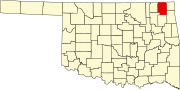 | |
| Towns | ||
| CDP | ||
|
Unincorporated community | ||
| Indian reservation | ||
| Footnotes | ‡This populated place also has portions in an adjacent county or counties | |
|
| This Oklahoma state location article is a stub. You can help Wikipedia by expanding it. |