| Whinney Banks | |
|---|---|
 St Francis of Assisi Church | |
.svg) Whinney Banks Location within
North Yorkshire | |
| OS grid reference | NZ476181 |
| Unitary authority | |
| Ceremonial county | |
| Region | |
| Country | England |
| Sovereign state | United Kingdom |
| Post town | MIDDLESBROUGH |
| Postcode district | TS5 |
| Police | Cleveland |
| Fire | Cleveland |
| Ambulance | North East |
Whinney Banks is an area in west Middlesbrough, North Yorkshire, England. The area is on the Old River Tees's southern banks, the river's main flow was redirected with the Mandale Cut, the A19 is between the old river and the area. It is within the TS5 postcode area and a part of the Ayresome ward, along with parts of Ayresome.
History
Whinney Banks was originally of around 550 houses, built in the 1930s and 1940s, forming part of a wider expanse of social housing in west Middlesbrough.
Gallery
-
 Whinney Banks Pond
 -
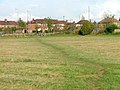 North part of Whinney Banks
 -
 Stainsby Road


.jpg)
References
External links
Places adjacent to Whinney Banks | |
|---|---|
|
| This Middlesbrough location article is a stub. You can help Wikipedia by expanding it. |