Wet Camp Village, Arizona | |
|---|---|
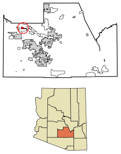
 Location of Wet Camp Village in Pinal County, Arizona. | |
| Coordinates: 33°8′29″N 111°54′4″W / 33.14139°N 111.90111°W | |
| Country | United States |
| State | Arizona |
| County | Pinal |
| Area | |
| • Total | 4.60 sq mi (11.90 km2) |
| • Land | 4.60 sq mi (11.90 km2) |
| • Water | 0.00 sq mi (0.00 km2) |
| Population (
2020) | |
| • Total | 300 |
| • Density | 65.27/sq mi (25.20/km2) |
| Time zone | UTC-7 ( MST (no DST)) |
| FIPS code | 04-82060 |
Wet Camp Village is a census-designated place in Pinal County, in the U.S. state of Arizona. [2] The population was 229 at the 2010 census. [3]
Demographics
| Census | Pop. | Note | %± |
|---|---|---|---|
| 2020 | 300 | — | |
| U.S. Decennial Census [4] | |||
References
- ^ "2020 U.S. Gazetteer Files". United States Census Bureau. Retrieved October 29, 2021.
- ^ U.S. Geological Survey Geographic Names Information System: Wet Camp Village, Arizona
- ^ "2010 Census Gazetteer Files – Places: New Mexico". U.S. Census Bureau. Retrieved February 26, 2017.
- ^ "Census of Population and Housing". Census.gov. Retrieved June 4, 2016.

