Ware County | |
|---|---|

Ware County Courthouse, Waycross | |
 Location within the U.S. state of
Georgia | |
 Georgia's location within the
U.S. | |
| Coordinates: 31°03′N 82°25′W / 31.05°N 82.42°W | |
| Country | |
| State | |
| Founded | December 15, 1824 |
| Named for | Nicholas Ware |
| Seat | Waycross |
| Largest city | Waycross |
| Area | |
| • Total | 908 sq mi (2,350 km2) |
| • Land | 892 sq mi (2,310 km2) |
| • Water | 16 sq mi (40 km2) 1.7% |
| Population (
2020) | |
| • Total | 36,251 |
| • Density | 41/sq mi (16/km2) |
| Time zone | UTC−5 ( Eastern) |
| • Summer ( DST) | UTC−4 ( EDT) |
| Congressional district | 1st |
| Website |
www |

Ware County is a county located in the southeastern part of the U.S. state of Georgia. As of the 2020 census, the population was 36,251. [1] The county seat and only incorporated place is Waycross. [2] Ware County is part of the Waycross, Georgia micropolitan statistical area.
History
Ware County, Georgia's 60th county, was created on December 15, 1824, by an act of the Georgia General Assembly from land that was originally part of Appling County.
The county is named for Nicholas Ware, the mayor of Augusta, Georgia from (1819–1821) and United States Senator who represented Georgia from 1821 until his death in 1824.
Several counties were later created from parts of the original Ware County borders:
- Bacon County (from portions of Appling, Pierce, and Ware counties in 1917)
- Charlton County (from portions of Camden and Ware county in 1854)
- Clinch County (from portions of Lowndes and Ware counties in 1850)
- Coffee County (from portions of Clinch, Irwin, Telfair, and Ware counties in 1854)
- Pierce County (from portions of Appling and Ware counties in 1857)
Ware County was home to Laura S. Walker (1861-1955) a noted author and conservationist. Walker promoted a comprehensive program of forestry activity, including the establishment of forest parks. She erected markers and monuments along old trails and at historic sites, in Waycross and Ware County so that local history would not be forgotten. Walker wrote three books about the land and history of her home. They are: History of Ware County, Georgia [3] About "Old Okefenåok" [4] and Doctors of Primitive Times and Horse and Buggy Days of Ware County. [5]
An effort to recognize her work culminated in President Franklin D. Roosevelt issuing a proclamation to establish the Laura S. Walker National Park, located in Ware County, in her honor. She was the only living person for whom a state or national park was named. [6] In 1937, the federal government purchased distressed farmland for the park. [7] [8] Work on the park was undertaken by the Works Progress Administration and the Civilian Conservation Corps. In 1941, the national park was deeded over to Georgia, becoming the State's 13th state park. [8]
Geography
According to the U.S. Census Bureau, the county has a total area of 908 square miles (2,350 km2), of which 892 square miles (2,310 km2) is land and 16 square miles (41 km2) (1.7%) is water. [9] It is the largest county in Georgia by area. A large portion of the county lies within the Okefenokee Swamp and its federally protected areas.
More than half of Ware County, made up by the western half of the southern portion of the county, the land bridge to the northern portion of the county, and the southern and western portion of the northern section of the county, is located in the Upper Suwannee River sub-basin of the Suwannee River basin. The eastern half of the southern portion of Ware County is located in the St. Marys River sub-basin of the St. Marys- Satilla River basin. The rest of the county, from just southeast to north and west of Waycross, is located in the Satilla River sub-basin of the same St. Marys-Satilla River basin. [10]
Major highways
Adjacent counties
- Bacon County - north
- Pierce County - east
- Brantley County - east
- Charlton County - southeast
- Baker County, Florida - south
- Clinch County - west
- Atkinson County - west
- Coffee County - northwest
National protected area
Communities
City
Census-designated places
Unincorporated communities
Demographics
| Census | Pop. | Note | %± |
|---|---|---|---|
| 1830 | 1,205 | — | |
| 1840 | 2,323 | 92.8% | |
| 1850 | 3,888 | 67.4% | |
| 1860 | 2,200 | −43.4% | |
| 1870 | 2,286 | 3.9% | |
| 1880 | 4,159 | 81.9% | |
| 1890 | 8,811 | 111.9% | |
| 1900 | 13,761 | 56.2% | |
| 1910 | 22,957 | 66.8% | |
| 1920 | 28,361 | 23.5% | |
| 1930 | 26,558 | −6.4% | |
| 1940 | 27,929 | 5.2% | |
| 1950 | 30,289 | 8.4% | |
| 1960 | 34,219 | 13.0% | |
| 1970 | 33,525 | −2.0% | |
| 1980 | 37,180 | 10.9% | |
| 1990 | 35,471 | −4.6% | |
| 2000 | 35,483 | 0.0% | |
| 2010 | 36,312 | 2.3% | |
| 2020 | 36,251 | −0.2% | |
| 2023 (est.) | 36,243 | [11] | 0.0% |
| U.S. Decennial Census
[12] 1790-1880 [13] 1890-1910 [14] 1920-1930 [15] 1930-1940 [16] 1940-1950 [17] 1960-1980 [18] 1980-2000 [19] 2010 [20] | |||
| Race | Num. | Perc. |
|---|---|---|
| White | 22,275 | 61.45% |
| Black or African American | 10,703 | 29.52% |
| Native American | 77 | 0.21% |
| Asian | 333 | 0.92% |
| Pacific Islander | 18 | 0.05% |
| Other/Mixed | 1,233 | 3.4% |
| Hispanic or Latino | 1,612 | 4.45% |
As of the 2020 United States census, there were 36,251 people, 13,823 households, and 8,909 families residing in the county.
Education
High schools
- Ware County High School, Waycross
Middle schools
- Ware County Middle School, Waycross
- Waycross Middle School, Waycross
Elementary schools
- Wacona Elementary School, Waycross
- Center Elementary School, Waycross
- Williams Heights Elementary School, Waycross
- Memorial Drive Elementary School, Waycross
- Ruskin Elementary School, Waycross
- Waresboro Elementary School, Waycross
Preschools
- DAFFODIL Preschool, Waycross
Private schools
- Southside Christian School
Higher education
- South Georgia State College, Waycross
- Coastal Pines Technical College, Waycross
Politics
| Year | Republican | Democratic | Third party | |||
|---|---|---|---|---|---|---|
| No. | % | No. | % | No. | % | |
| 2020 | 9,903 | 69.79% | 4,169 | 29.38% | 117 | 0.82% |
| 2016 | 8,513 | 69.87% | 3,440 | 28.23% | 231 | 1.90% |
| 2012 | 7,941 | 66.44% | 3,900 | 32.63% | 112 | 0.94% |
| 2008 | 8,311 | 66.83% | 4,034 | 32.44% | 91 | 0.73% |
| 2004 | 7,790 | 68.99% | 3,449 | 30.55% | 52 | 0.46% |
| 2000 | 6,099 | 63.35% | 3,480 | 36.14% | 49 | 0.51% |
| 1996 | 4,746 | 49.55% | 4,171 | 43.54% | 662 | 6.91% |
| 1992 | 4,573 | 43.87% | 4,573 | 43.87% | 1,278 | 12.26% |
| 1988 | 4,819 | 52.59% | 4,292 | 46.84% | 52 | 0.57% |
| 1984 | 5,547 | 55.57% | 4,435 | 44.43% | 0 | 0.00% |
| 1980 | 3,715 | 36.65% | 6,307 | 62.22% | 115 | 1.13% |
| 1976 | 2,661 | 25.64% | 7,719 | 74.36% | 0 | 0.00% |
| 1972 | 6,578 | 79.23% | 1,724 | 20.77% | 0 | 0.00% |
| 1968 | 2,047 | 20.07% | 2,255 | 22.11% | 5,895 | 57.81% |
| 1964 | 4,948 | 48.81% | 5,189 | 51.19% | 0 | 0.00% |
| 1960 | 2,235 | 30.47% | 5,099 | 69.53% | 0 | 0.00% |
| 1956 | 2,276 | 27.88% | 5,888 | 72.12% | 0 | 0.00% |
| 1952 | 2,418 | 30.06% | 5,627 | 69.94% | 0 | 0.00% |
| 1948 | 655 | 14.09% | 2,611 | 56.15% | 1,384 | 29.76% |
| 1944 | 459 | 16.59% | 2,306 | 83.34% | 2 | 0.07% |
| 1940 | 308 | 10.31% | 2,672 | 89.48% | 6 | 0.20% |
| 1936 | 256 | 9.06% | 2,566 | 90.77% | 5 | 0.18% |
| 1932 | 205 | 7.53% | 2,504 | 91.96% | 14 | 0.51% |
| 1928 | 1,339 | 48.60% | 1,416 | 51.40% | 0 | 0.00% |
| 1924 | 216 | 10.82% | 1,497 | 75.00% | 283 | 14.18% |
| 1920 | 215 | 19.27% | 901 | 80.73% | 0 | 0.00% |
| 1916 | 59 | 4.69% | 1,066 | 84.74% | 133 | 10.57% |
| 1912 | 39 | 3.66% | 972 | 91.27% | 54 | 5.07% |
| 1908 | 190 | 18.85% | 771 | 76.49% | 47 | 4.66% |
| 1904 | 158 | 19.46% | 635 | 78.20% | 19 | 2.34% |
| 1900 | 107 | 15.11% | 601 | 84.89% | 0 | 0.00% |
| 1896 | 330 | 36.11% | 545 | 59.63% | 39 | 4.27% |
| 1892 | 262 | 23.06% | 775 | 68.22% | 99 | 8.71% |
| 1888 | 186 | 32.52% | 369 | 64.51% | 17 | 2.97% |
| 1884 | 179 | 32.90% | 365 | 67.10% | 0 | 0.00% |
| 1880 | 201 | 36.28% | 353 | 63.72% | 0 | 0.00% |
See also
- National Register of Historic Places listings in Ware County, Georgia
- Obediah Barber Homestead
- Laura S. Walker State Park
- List of counties in Georgia
References
- ^ "Census - Geography Profile: Ware County, Georgia". United States Census Bureau. Retrieved December 29, 2022.
- ^ "Find a County". National Association of Counties. Retrieved June 7, 2011.
- ^ Laura Singleton Walker (1990). History of Ware County, Georgia. Southern Historical Press. ISBN 978-0-89308-106-5.
- ^ Laura Singleton Walker; Sara Singleton King (1947). About "Old Okefenåok".
- ^ Laura Singleton Walker (1940). Doctors of Primitive Times and Horse and Buggy Days of Ware County.
- ^ "Laura S. Walker: The Woman Behind the Park". Friends of Georgia State Parks and Historic Sites. Retrieved April 13, 2018.
- ^ Thomas J. Straka; S. Knight Cox; Heather T. Irwin. "Current Use of Federal Land Utilization Projects Granted to State and Local Agencies" (PDF). Department of Forestry and Natural Resources Clemson University. Archived (PDF) from the original on April 14, 2018. Retrieved April 13, 2018.
- ^ a b "Laura S. Walker State Park Established 1941" (PDF). Georgia Department of Natural Resources. Archived (PDF) from the original on January 7, 2018. Retrieved April 13, 2018.
- ^ "US Gazetteer files: 2010, 2000, and 1990". United States Census Bureau. February 12, 2011. Retrieved April 23, 2011.
- ^ "Georgia Soil and Water Conservation Commission Interactive Mapping Experience". Georgia Soil and Water Conservation Commission. Archived from the original on October 3, 2018. Retrieved November 27, 2015.
- ^ "Annual Estimates of the Resident Population for Counties: April 1, 2020 to July 1, 2023". United States Census Bureau. Retrieved March 31, 2024.
- ^ "Decennial Census of Population and Housing by Decades". United States Census Bureau.
- ^ "1880 Census Population by Counties 1790-1800" (PDF). United States Census Bureau. 1880.
- ^ "1910 Census of Population - Georgia" (PDF). United States Census Bureau. 1910.
- ^ "1930 Census of Population - Georgia" (PDF). United States Census Bureau. 1930.
- ^ "1940 Census of Population - Georgia" (PDF). United States Census Bureau. 1940.
- ^ "1950 Census of Population - Georgia -" (PDF). United States Census Bureau. 1950.
- ^ "1980 Census of Population - Number of Inhabitants - Georgia" (PDF). United States Census Bureau. 1980.
- ^ "2000 Census of Population - Population and Housing Unit Counts - Georgia" (PDF). United States Census Bureau. 2000.
- ^ "State & County QuickFacts". United States Census Bureau. Archived from the original on August 3, 2011. Retrieved June 27, 2014.
- ^ "Explore Census Data". data.census.gov. Retrieved December 9, 2021.
- ^ Leip, David. "Dave Leip's Atlas of U.S. Presidential Elections". uselectionatlas.org. Retrieved March 24, 2018.
External links
- Official Ware County website
- Ware County Community Website & Community Calendar
- History of Ware County, Georgia - Laura S. Walker
- Doctors of Primitive Times and Horse and Buggy Days of Ware County - Laura S. Walker
- Georgia GenWeb Ware County site
- Okefenokee Swamp Park homepage
- Okefenokee National Wildlife Refuge U.S. Fish and Wildlife Service
Places adjacent to Ware County, Georgia | ||||||||||||||||
|---|---|---|---|---|---|---|---|---|---|---|---|---|---|---|---|---|
| ||||||||||||||||
Municipalities and communities of
Ware County, Georgia, United States | ||
|---|---|---|
| City | 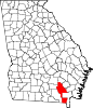 | |
| CDPs | ||
|
Other unincorporated communities | ||
| Footnotes | ‡This populated place also has portions in an adjacent county or counties | |
| International | |
|---|---|
| National | |