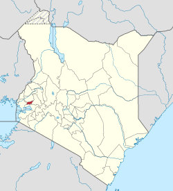
Vihiga County | |
|---|---|
 Location in Kenya | |
| Country | |
| Formed | 4 March 2013 |
| Capital | Mbale |
| Government | |
| • Governor | Wilber Otichilo |
| Area | |
| • Total | 531.3 km2 (205.1 sq mi) |
| Population (2019) | |
| • Total | 590,013 [1] |
| Time zone | UTC+3 ( EAT) |
| Website | vihiga.go.ke |
Vihiga County is an administrative region in the former Western Province of Kenya whose headquarters are in Mbale, the largest town in the county. The county has a population of 554,622 [1] (2009 census) and an area of 563 km2. [2] Formerly a district, Vihiga was split from Kakamega District in 1990. [3] In 2019's census, Vihiga was found to have a population of 590,013, an increase of 35,391 from 2009's count. [4]
Religion
Religion in Vihiga County [5]
| Religion (2019 Census) | Number |
|---|---|
| Catholicism | 22,331 |
| Protestant | 201,738 |
| Evangelical Churches | 240,628 |
| African instituted Churches | 88,697 |
| Orthodox | 4,913 |
| Other Cristian | 13,469 |
| Islam | 5.796 |
| Hindu | 31 |
| Traditionists | 1,148 |
| Other | 4,639 |
| No Religion Atheists | 3,337 |
| Don't Know | 389 |
| Not Stated | 73 |
Local authorities
| Authority | Type | Population* | Urban pop.* |
|---|---|---|---|
| Vihiga | Municipality | 98,189 | 19,067 |
| Luanda | Town | 68,157 | 8,757 |
| Vihiga county | County | 332,537 | 0 |
| * 1999 census. Source: [1][ permanent dead link] | |||
Administrative divisions
| Division | Population* | Urban pop.* | Headquarters |
|---|---|---|---|
| Emuhaya | 69,250 | 0 | |
| Luanda | 92,462 | 8.016 | Luanda, Kenya |
| Sabatia | 117,863 | 10.135 | |
| Tiriki East | 59,943 | 0 | |
| Tiriki West | 76,370 | 0 | |
| Vihiga | 82,995 | 6.881 | Vihiga |
| * 1999 census. Sources: [2], [3], | |||
Constituencies
The district has five constituencies:
- Emuhaya Constituency
- Hamisi Constituency
- Sabatia Constituency
- Vihiga Constituency
- Luanda Constituency
Notable people
- Moses Mudavadi Cabinet minister
- Musalia Mudavadi Kenya's 7th Vice President of Kenya.
References
- ^ a b "Kenya Census 2009 | PDF | Census | Waste Management".
- ^ statoids.com – Districts of Kenya
- ^ Amutabi Lutta Mukhebi
- ^ "2019 Kenya Population and Housing Census Volume I: Population by County and Sub-County". Kenya National Bureau of Statistics. Retrieved 7 December 2019.
- ^ "2019 Kenya Population and Housing Census Volume IV: Distribution of Population by Socio-Economic Characteristics" (PDF). Kenya National Bureau of Statistics. Retrieved 2 May 2021.
External links
0°4′N 34°40′E / 0.067°N 34.667°E

