| Vangsmjøse | |
|---|---|
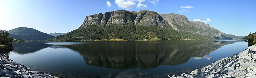
 View of the lake | |
 Vangsmjøse Location of the lake  Vangsmjøse Vangsmjøse (Norway) | |
| Location | Vang Municipality, Innlandet |
| Coordinates | 61°09′46″N 08°26′30″E / 61.16278°N 8.44167°E |
| Basin countries | Norway |
| Max. length | 13 kilometres (8.1 mi) |
| Max. width | 2 kilometres (1.2 mi) |
| Surface area | 18.448 km2 (7.123 sq mi) |
| Max. depth | 154 metres (505 ft) |
| Shore length1 | 43.47 kilometres (27.01 mi) |
| Surface elevation | 466 metres (1,529 ft) |
| References | NVE [1] |
| 1 Shore length is not a well-defined measure. | |
Vangsmjøse (also spelled as Vangsmjøsa or Vangsmjøsi) is a lake in Vang Municipality in Innlandet county, Norway. The lake has an area of 18.448 square kilometres (7.123 sq mi) and it has a maximum depth of about 154 metres (505 ft) deep. A local myth says that if a raw ham is lowered into the deepest part of Vangsmjøse, it will be boiled when it is pulled back up. The lake sits at an elevation of 466 metres (1,529 ft) above sea level and it has a shoreline measuring about 43.5 kilometres (27.0 mi) around. [2]
Øye Stave Church is situated in the village of Øye which sits at the west end of Vangsmjøse. The scenic European route E16 runs through Øye and along the south shore of Vangsmjøse. [3]
Media gallery
-
 Panorama of the western part of the lake
 -
 Other view of Vangsmjøse


See also
References
- ^ "Innsjødatabase". nve.no (in Norwegian). Retrieved 28 August 2022.
- ^ Thorsnæs, Geir, ed. (19 February 2021). "Vangsmjøse". Store norske leksikon (in Norwegian). Kunnskapsforlaget. Retrieved 28 August 2022.
- ^ Hermundstad, K. (1969). Vang stavkyrkje: truleg bygd ikr. 1175 (in Norwegian Nynorsk). Valdres trykkeri. p. 5. Retrieved 5 June 2019.
External links