Vandiver, Alabama | |
|---|---|
 Location of Vandiver in Shelby County, Alabama. | |
 Vandiver, Alabama  Vandiver, Alabama | |
| Coordinates: 33°28′14″N 86°30′48″W / 33.4706617°N 86.5133163°W | |
| Country | United States |
| State | Alabama |
| County | Shelby |
| Area | |
| • Total | 20.85 sq mi (54.01 km2) |
| • Land | 20.31 sq mi (52.60 km2) |
| • Water | 0.54 sq mi (1.41 km2) |
| Elevation | 531 ft (162 m) |
| Population (
2020) | |
| • Total | 1,084 |
| • Density | 53.37/sq mi (20.61/km2) |
| Time zone | UTC-6 ( Central (CST)) |
| • Summer ( DST) | UTC-5 (CDT) |
| Area code(s) | 205, 659 |
| GNIS feature ID | 128408 [2] |
Vandiver is a census-designated place (CDP) and unincorporated community in Shelby County, Alabama, United States. Its population was 1,084 as of the 2020 census. One structure in Vandiver, the Falkner School, is listed on the Alabama Register of Landmarks and Heritage. [3]
Geography
The community is in the northeastern part of Shelby County. Alabama State Route 25 runs through the community, leading southeast 10 mi (16 km) to Vincent and north 10 mi (16 km) on an winding and mountainous route to the city of Leeds.
Demographics
| Census | Pop. | Note | %± |
|---|---|---|---|
| 2020 | 1,084 | — | |
| U.S. Decennial Census [4] | |||
Notable people
- Wes Helms, former Major League Baseball player
References
- ^ "2020 U.S. Gazetteer Files". United States Census Bureau. Retrieved October 29, 2021.
- ^ "Vandiver". Geographic Names Information System. United States Geological Survey, United States Department of the Interior.
- ^ "Properties on the Alabama Register of Landmarks & Heritage". Alabama Historical Commission. www.preserveala.org. Archived from the original on September 4, 2012. Retrieved June 5, 2014.
- ^ "Census of Population and Housing". Census.gov. Retrieved June 4, 2016.
Municipalities and communities of
Shelby County, Alabama, United States | ||
|---|---|---|
| Cities | 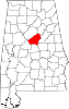 | |
| Towns | ||
| CDPs | ||
|
Other unincorporated communities | ||
| Footnotes | ‡This populated place also has portions in an adjacent county or counties | |
|
| This Shelby County, Alabama state location article is a stub. You can help Wikipedia by expanding it. |