Vainupea | |
|---|---|
Village | |
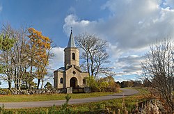
 Vainupea chapel | |
| Country | |
| County | Lääne-Viru County |
| Parish | Haljala Parish |
| Time zone | UTC+2 ( EET) |
| • Summer ( DST) | UTC+3 ( EEST) |
Vainupea is a village in Haljala Parish, Lääne-Viru County, in northern Estonia, [1] on the territory of Lahemaa National Park. The village includes the island of Vaindloo, making it the northernmost settlement in Estonia.
Gallery
-
Beach at Vainupea
-
Vainupea light beacon
References
- ^ Classification of Estonian administrative units and settlements 2014[ dead link] (retrieved 28 July 2021)
59°35′N 26°16′E / 59.583°N 26.267°E


