Vail Mills, New York | |
|---|---|
| Coordinates: 43°03′00″N 74°13′04″W / 43.0500735°N 74.2179100°W [1] | |
| Country | United States |
| State | New York |
| County | Fulton |
| Town | Mayfield |
| Elevation | 781 ft (238 m) |
| Time zone | UTC-5 ( Eastern (EST)) |
| • Summer ( DST) | UTC-4 (EDT) |
| Area code | 518 |
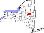
Vail Mills is a hamlet in the Town of Mayfield in Fulton County, New York, United States. It is located in the southeastern part of the town on New York State Route 30 (NY 30).
References
- ^ "Vail Mills". Geographic Names Information System. United States Geological Survey, United States Department of the Interior. Retrieved 2019-05-13.

