| Upper Colony Fire | |
|---|---|
 The Upper Colony Fire on June 17, 2018 | |
| Date(s) | June 17, 2018 – June 22, 2018 |
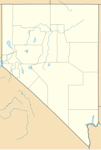
| Location | Smith Valley, Nevada, United States |
| Coordinates | 38°49′01″N 119°24′11″W / 38.817°N 119.403°W |
| Statistics [1] | |
| Burned area | 1,202 acres (5 km2) |
| Ignition | |
| Cause | Vehicle |
| Map | |
The Upper Colony Fire was a wildfire in Smith Valley, Nevada in the United States. The fire was started on June 17, 2018, and was contained on June 22. It burned a total of 1,202 acres (5 km2). The fire was started by truck brakes that overheated and caught dry grass on fire.
Events
The Upper Colony Fire was reported on June 17, 2018, around 11:44 am west of Upper Colony Road in Smith Valley, Nevada. The fire, which was caused when a truck's brakes overheated and set grass on fire, was fueled by high brush and timber litter. [1] [2] The fire threatened properties including ranches and horse farms, greater sage-grouse habitats, and Burbank Canyons Wilderness Study Area. [1] The fire was contained on June 22, 2018, at 1,202 acres (5 km2). [2]
References
- ^ a b c "Upper Colony Fire". InciWeb. Carson City District Office Bureau of Land Management. Retrieved 24 June 2018.
- ^ a b Hildebrand, Kurt. "The June 25 R-C Morning Report". The Record-Courier. Archived from the original on 25 June 2018. Retrieved 25 June 2018.
![]() This article incorporates
public domain material from this U.S government document.
This article incorporates
public domain material from this U.S government document.
