| Unac | |
|---|---|
 | |
|
| |
| Location | |
| Country | Bosnia and Herzegovina |
| Physical characteristics | |
| Source | |
| • location | Preodac |
| Mouth | |
• location | Una, Martin Brod |
• coordinates | 44°29′42″N 16°08′08″E / 44.49500°N 16.13556°E |
| Basin features | |
| Progression | Una→ Sava→ Danube→ Black Sea |
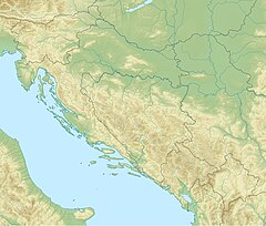
The Unac ( Serbian Cyrillic: Унац) is a sinking river in Bosnia and Herzegovina. It rises beneath Šator mountain, flows through the municipality of Drvar and finally meets Una River in Martin Brod. Also runs through two deep and rugged karstic canyons and it is dammed to form small Preodačko Lake and larger Župica Lake, before it reach town of Drvar. [1]
Lower course of the Unac River and its canyon is included into the Una National Park.
The confluence of Una and Unac is the location of the medieval Rmanj Fortress, as well as the Rmanj Monastery.
-
Unac leaving a canyon at Martin Brod outskirts.
-
Flyfishing on the Unac at the outskirts of Martin Brod.
See also
References
- ^ "Water Management Strategy". Bosnia and Herzegovina Federation of Bosnia and Herzegovina Federal Ministry of Agriculture, Water Management and Forestry. Retrieved 20 July 2011.
External links
Wikimedia Commons has media related to
Unac (river).


