This article needs additional citations for
verification. (April 2021) |
Tudor, California | |
|---|---|
 Tudor, California  Tudor, California | |
| Coordinates: 39°00′18″N 121°37′25″W / 39.00500°N 121.62361°W | |
| Country | United States |
| State | California |
| County | Sutter |
| Elevation | 43 ft (13 m) |
| Time zone | UTC-8 ( Pacific (PST)) |
| • Summer ( DST) | UTC-7 (PDT) |
| Area code | 530 |
| GNIS feature ID | 1660038 [1] |
Tudor is an unincorporated community in Sutter County, California, United States. [1] [2] In the early twentieth century, Tudor was a major center of bean farming, with lima, kidney, and blackeye beans grown in the area. [3]
Notes
- ^ a b "Tudor, California". Geographic Names Information System. United States Geological Survey, United States Department of the Interior.
- ^ Tudor Topo Map in Sutter County CA
- ^ "Late Agricultural News". Pacific Rural Press. San Francisco, CA. June 13, 1925. Retrieved November 24, 2023.
Municipalities and communities of
Sutter County, California, United States | ||
|---|---|---|
| Cities | 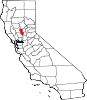 | |
| CDPs | ||
|
Unincorporated communities | ||
|
| This Sutter County, California-related article is a stub. You can help Wikipedia by expanding it. |