Trousdale is a ghost town in Pottawatomie County, Oklahoma, [1] at an elevation of 960 feet. [2] It is located about 6 miles south of Tribbey, Oklahoma, just west of Oklahoma State Highway 102. [3]
It was named for William F.A. "Billy" Trousdale, early sheriff of Pottawatomie County. [4] The settlement was created on March 7, 1904, shortly after the railroad came through in 1903. [4] In 1957 the citizens of Trousdale voted to annex their school district to Tribbey. [4] The post office closed June 16, 1967. [4]
References
- ^ "Trousdale". Geographic Names Information System. United States Geological Survey, United States Department of the Interior. Retrieved July 10, 2021.
- ^ "Trousdale, Oklahoma". RoadsideThoughts. Retrieved June 30, 2021.
- ^ "Tribbey, Oklahoma to Trousdale, Oklahoma". Google Maps. Retrieved June 30, 2021.
- ^ a b c d "Trousdale". Rootsweb.com. Retrieved June 30, 2021.
Municipalities and communities of
Pottawatomie County, Oklahoma, United States | ||
|---|---|---|
| Cities | 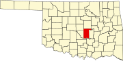 | |
| Towns | ||
| CDP | ||
|
Other communities | ||
| Ghost towns | ||
| Footnotes | ‡This populated place also has portions in an adjacent county or counties | |
35°02′28″N 97°02′34″W / 35.04111°N 97.04278°W
|
| This Oklahoma state location article is a stub. You can help Wikipedia by expanding it. |