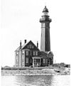
 The Toronto Harbour Light | |
|
| |
| Location | Tommy Thompson Park, Toronto |
|---|---|
| Coordinates | 43°36′49″N 79°20′36″W / 43.613545°N 79.34339°W |
| Tower | |
| Constructed | 1974 |
| Construction | steel tower |
| Height | 12 metres (39 ft) |
| Shape | octagonal steel tower with light |
| Markings | white lower part tower, red upper part tower |
| Operator | PortsToronto |
| Light | |
| Focal height | 22 metres (72 ft) |
| Characteristic | Fl R 10s. |
The Toronto Harbour Light is an automated lighthouse at Vicki Keith Point on the Leslie Street Spit in Toronto, Ontario, Canada.
Construction
The concrete structure was completed in 1974 by the then Toronto Harbour Commission. It is now operated by the Toronto Port Authority. The lighthouse is powered by a solar panel and directs shipping traffic along the Eastern Channel into Toronto Harbrour.
See also
Further reading
- Crompton, Samuel Willard & Michael J. Rhein. The Ultimate Book of Lighthouses (2002) ISBN 1-59223-102-0; ISBN 978-1-59223-102-7.
- Jones, Ray, & Roberts, Bruce (Photographer). Eastern Great Lakes Lighthouses (Lighthouse Series) (Paperback) (Old Saybrook, CN: The Globe Pequot Press) ISBN 1-56440-899-X.
- Jones, Ray.The Lighthouse Encyclopedia, The Definitive Reference (Globe Pequot, January 1, 2004, 1st ed.) ISBN 0-7627-2735-7; ISBN 978-0-7627-2735-3.
- Oleszewski, Wes. Great Lakes Lighthouses, American and Canadian: A Comprehensive Directory/Guide to Great Lakes Lighthouses, (Gwinn, Michigan: Avery Color Studios, Inc., 1998) ISBN 0-932212-98-0.
- Penrose, Laurie & Penrose, Bill T., (1994-05) A Traveler's Guide to 100 Eastern Great Lakes: Lighthouses (Paperback), Friede Publications, 125 pages ISBN 0-923756-09-4, p. 79.
- Wright, Larry and Wright, Patricia. Great Lakes Lighthouses Encyclopedia Hardback (Erin: Boston Mills Press, 2006) ISBN 1-55046-399-3
External links
- The Toronto Harbour Light
- Aids to Navigation Canadian Coast Guard
