Tinúm | |
|---|---|
 | |
 Region 6 Oriente #091 | |
 Tinúm Location of the Municipality in Mexico | |
| Coordinates: 20°45′59″N 88°23′30″W / 20.76639°N 88.39167°W | |
| Country |
|
| State |
|
| Mexico Ind. | 1821 |
| Yucatán Est. | 1824 |
| Government | |
| • Type |
|
| • Municipal President | Natalia Mis Mex [2] |
| Area | |
| • Total | 393.44 km2 (151.91 sq mi) |
| [2] | |
| Elevation | 24 m (79 ft) |
| Population (2010
[3]) | |
| • Total | 11,421 |
| • Density | 29/km2 (75/sq mi) |
| • Demonym | Umanense |
| Time zone | UTC-6 ( Central Standard Time) |
| • Summer ( DST) | UTC-5 ( Central Daylight Time) |
| INEGI Code | 091 |
| Major Airport | Merida (Manuel Crescencio Rejón) International Airport |
| IATA Code | MID |
| ICAO Code | MMMD |
| Municipalities of Yucatán | |
Tinúm Municipality ( Yucatec Maya: "crippled numtzutzuy [n 1]") [5] is a municipality in the Mexican state of Yucatán containing (393.44 km2 or 151.91 sq mi) of land and is located roughly 140 kilometres (87 mi) east of the city of Mérida. [2]
History
There is no accurate data on when the town was founded, but it was a settlement before the conquest and was located in the chieftainship of Cupules. Within the municipality is Chichen Itza, a city built in the Post Classic Maya period, which reached its apex between the 11th and 12th centuries.
After colonization by the Spanish, the area became part of the encomienda system with various encomenderos, [2] beginning with Juan García de Llanos in 1549 and passing to the crown in 1551. In 1607, it passed to Baltasar Pacheco Dorantes. [6]
Yucatán declared its independence from the Spanish Crown in 1821. In 1825 [7] the Mexican government assigned this community to the Valladolid Municipality. In 1918 Tinúm was designated as an independent municipality. [2]
Governance
The municipal president is elected for a three-year term. The town council has seven councilpersons, who serve as Secretary and councilors of public works, police commissaries, education, ecology, public monuments and sports. [8]
Communities
The seat of the municipality is Tinúm. The municipality has 37 populated places [8] besides the seat, including Balantún, Chichén Itzá, Chichil, Dzulotok, Macuchén, Pisté, San Francisco, San Felipe, San Felipe Nuevo, San José, San Nicolás, Santa María, Tohopkú, and X-Calakoop. The significant populations are shown below: [2]
| Community | Population |
|---|---|
| Entire Municipality (2010) | 11,421 [3] |
| Pisté | 4467 in 2005 [9] |
| San Francisco | 1444 in 2005 [10] |
| Tinúm | 1980 in 2005 [11] |
| Tohopkú | 470 in 2005 [12] |
| X-Calakoop | 1239 in 2005 [13] |
-
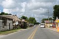
 Pisté
Pisté -
 X-Calacoop


Local festivals
Every year on 12 June, the town celebrates the feast of Saint Anthony of Padua, its patron saint. [2]
Tourist attractions
- Church of Saint Anthony of Padua, built during the colonial era
- Church of Conception, built during the colonial era
- archeological sites at Bacancú, Canahum, Chichen Itza, Dzibiac, Halacal, Joya de Erik Thompson, Pisté, San Francisco Semé, San Juan Holtún, Tikincab, La Venta and Xnabá.
- Sacred Cenote
- Hacienda Chichén
Notes
- ^ "cereus pentagonus: Numtzutzuy (Gaumer); reported also as "nuntzutzuy." Sp. Tuna silvestre. Common. Stems climbing, 3-5-angled, rarely 6-8-angled, the spines 4 cm. long or less; flowers 14-20 cm. long, white; fruit large, red. The fruit is edible. The spines are sometimes used as a substitute for pins". [4]
References
- ^ "Aprueban registros" (in Spanish). Mérida, Mexico: Diario de Yucatán. 3 April 2015. Retrieved 15 August 2015.
- ^ a b c d e f g h "Municipios de Yucatán »Tinúm" (in Spanish). Retrieved 15 August 2015.
- ^ a b "Mexico In Figures:Tinúm, Yucatán". INEGI (in Spanish and English). Aguascalientes, México: Instituto Nacional de Estadística y Geografía (INEGI). Archived from the original on 6 May 2015. Retrieved 15 August 2015.
- ^ Standley, Paul C. (1930). "Flora of Yucatán". Chicago, Illinois: Field Museum of Natural History. p. 366. Retrieved 15 August 2015.
- ^ "El Significado de los Nombres de los Pueblos de Yucatán: Plantas". Merida de Yucatan (in Spanish). Mérida, Mexico: Crónicas de la Ciudad Blanca. Retrieved 15 August 2015.
- ^ García Bernal, Manuela Cristina (1978). Población y encomienda en Yucatán bajo los Austrias (in Spanish). Sevilla: Escuela de Estudios Hispano-Americanos. p. 515. ISBN 978-8-400-04399-5. Retrieved 15 August 2015.
- ^ "Estado de Yucatán. División Territorial de 1810 a 1995" (PDF). inegi (in Spanish). Aguascalientes, Mexico: Instituto Nacional de Estadística, Geografía e Informática. 1996. p. 15. Archived from the original (PDF) on 2015-12-23. Retrieved 15 August 2015.
- ^ a b "Tinúm". inafed (in Spanish). Mérida, Mexico: Enciclopedia de Los Municipios y Delegaciones de México. Retrieved 15 August 2015.
- ^ "Pisté" (in Spanish). PueblosAmerica. 2005. Retrieved 15 August 2015.
- ^ "San Francisco" (in Spanish). PueblosAmerica. 2005. Retrieved 15 August 2015.
- ^ "Tinúm" (in Spanish). PueblosAmerica. 2005. Retrieved 15 August 2015.
- ^ "Tohopkú" (in Spanish). PueblosAmerica. 2005. Retrieved 15 August 2015.
- ^ "X-Calakoop" (in Spanish). PueblosAmerica. 2005. Retrieved 15 August 2015.
Mérida (capital) | |||||||||||||||
| Topics |  | ||||||||||||||
| Metros | |||||||||||||||
| Larger cities | |||||||||||||||
| Smaller cities |
| ||||||||||||||
| Municipalities |
| ||||||||||||||