The Raunt | |||||||||||
|---|---|---|---|---|---|---|---|---|---|---|---|
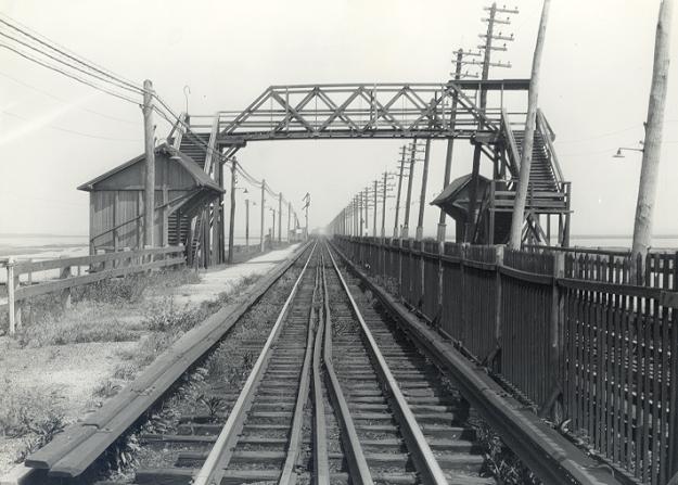
 Aerial view of the former station site in 2019 | |||||||||||
| General information | |||||||||||
| Location |
Jamaica Bay Queens, New York City | ||||||||||
| Coordinates | 40°37′10.8″N 73°49′08.2″W / 40.619667°N 73.818944°W | ||||||||||
| Line(s) | Rockaway Beach Branch | ||||||||||
| Platforms | 2 side platforms | ||||||||||
| Tracks | 2 | ||||||||||
| History | |||||||||||
| Opened | 1888 | ||||||||||
| Closed | May 23, 1950 | ||||||||||
| Electrified | July 26, 1905 | ||||||||||
| Former services | |||||||||||
| |||||||||||
The Raunt was a former Long Island Rail Road station on the Rockaway Beach Branch. It had no address and no station house, because it was meant strictly as a dropping-off point for fishermen using a small island in Jamaica Bay. [1] [2] The station was located 1,300 feet (400 m) west of signal station "ER" (presumably #96), and near the WU Tower. It was named for the channel on the south side of the island where it stood. [2]
History

The Raunt station opened in 1888 by the New York and Rockaway Beach Railway. [1] [3] [4] It had a wooden pedestrian bridge between the two sheltered platforms, and was electrified on July 26, 1905. [5] [6] The Jamaica Bay Trestle was prone to fires, but The Raunt was the source of a May 7–8, 1950 fire that broke out between here and Broad Channel, destroyed the bridge over Jamaica Bay and thus doomed the entire line. [7] Service on the Rockaway Beach Branch west of Hammels continued only via the Far Rockaway Branch, until October 3, 1955, when the branch was abandoned west of Far Rockaway itself, along with the entire Rockaway Beach Branch south of Ozone Park.
Both branches were sold to the New York City Transit Authority, which replaced the Rockaway Beach Branch, and the Queens half of the Far Rockaway Branch with the IND Rockaway Line. The Broad Channel station was replaced in 1956 as a New York City Subway station, but the small community at The Raunt was ordered demolished by New York City parks commissioner Robert Moses and became part of the Jamaica Bay Wildlife Refuge. [8] [9]
References
- ^ a b Lucev, Emil (October 15, 2004). "Historical Views of the Rockaways". The Wave. Retrieved 2010-03-27.
- ^ a b Brooklyn, NY Quadrangle (Map). 1:62,500. 15 Minute Series (Topographic). United States Geological Survey. 1898. § SE. Retrieved 2010-03-27.
- ^ Hendrick, Daniel M. (2006). Jamaica Bay. Images of America. Charleston: Arcadia. p. 34. ISBN 0-7385-4559-7.
- ^ Zeil, Ron; Wettereau, Richard (1988). Victorian Railroad Stations of Long Island. Bridgehampton: Sunrise Special. p. 88. OCLC 19319353.
- ^ Meyers, Stephen L. (2006). Lost Trolleys of Queens and Long Island. Images of Rail. Charleston: Arcadia. p. 119. ISBN 0-7385-4526-0.
- ^ Seyfried, Vincent F.; Asadorian, William (1991). Old Queens, N.Y., in Early Photographs. New York: Dover. p. xi. ISBN 0-486-26358-4.
- ^ "PRR Chronology, 1950" (PDF). (50.5 KiB), December 2004 Edition
- ^ Ferris, John (March 17, 1967). "Pilgrimage to an Urban Eden". Life. pp. 26–28. Retrieved 2010-03-27.
- ^ Barlow, Elizabeth (December 8, 1969). "Keeping Jamaica Bay For the Birds". New York. pp. 56–62. Retrieved 2010-03-27.