(Redirected from
Territorial evolution of North Dakota)

The following outline traces the territorial evolution of the U.S. State of North Dakota.
Outline


- Historical territorial claims of the
United Kingdom in the present
State of North Dakota:
- Rupert's Land, 1670–1870
- Historical territorial claims of
France in the present
State of North Dakota:
- Louisiane, 1682–1764
- Historical territorial claims of
Spain in the present
State of North Dakota:
-
Luisiana, 1764–1803
- Third Treaty of San Ildefonso of 1800
-
Luisiana, 1764–1803
- Historical territorial claims of
France in the present
State of North Dakota:
-
Louisiane, 1803
- Vente de la Louisiane of 1803
-
Louisiane, 1803
- Historical
political divisions of the United States in the present
State of North Dakota:
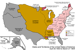
- Unorganized territory created by the Louisiana Purchase, 1803–1804
- District of Louisiana, 1804–1805
- Territory of Louisiana, 1805–1812
- Territory of Missouri, 1812–1821
- Unorganized territory formerly the northwestern Missouri Territory, 1821–1854
- Territory of Michigan east of Missouri River and White Earth River, 1805-(1834–1836)-1837
- Territory of Wisconsin east of Missouri River and White Earth River, (1836–1838)-1848
- Territory of Iowa east of Missouri River and White Earth River, 1838–1846
- Territory of Minnesota east of Missouri River and White Earth River, 1849–1858
- Territory of Nebraska west of Missouri River or White Earth River, (1854–1861)-1867
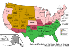
- Territory of Dakota, 1861-1889 [1]
- State of North Dakota, since November 2, 1889 [2]
See also
- Historical outline of North Dakota
- History of North Dakota
- Territorial evolution of the United States
-
 Territorial evolution of Minnesota
 -
 Territorial evolution of Montana
 -
 Territorial evolution of South Dakota
References
- ^ Thirty-sixth United States Congress (March 2, 1861). "An Act to provide a temporary Government for the Territory of Dakota, and to create the Office of Surveyor General therein" ( cgi-bin). Retrieved June 16, 2009.
- ^ Benjamin Harrison (November 2, 1889). "By the President of the United States of America, A Proclamation Admitting the State of North Dakota to the Union". Retrieved June 16, 2009.
