Teaselville, Texas | |
|---|---|
 Teaselville, Texas  Teaselville, Texas | |
| Coordinates: 32°08′53″N 95°24′17″W / 32.14806°N 95.40472°W | |
| Country | United States |
| State | Texas |
| County | Smith |
| Elevation | 417 ft (127 m) |
| Population (2000)
[1] | |
| • Total | 150 |
| Time zone | UTC-6 ( Central (CST)) |
| • Summer ( DST) | UTC-5 (CDT) |
| Area code(s) | 430 & 903 |
| GNIS feature ID | 1379141 [2] |
Teaselville, also known as Loftin, is an unincorporated community in Smith County, Texas, United States. Teaselville is located at the junction of Farm to Market Road 344 and Farm to Market Road 346, 4 miles (6.4 km) west of Bullard.
History
Teaselville was inhabited by 1846, and the community was formed in 1850. A post office opened in Teaselville in 1900 and closed by 1936. The population of Teaselville was 150 in 2000. [3]
Currently, the community consists of a coffee shop and a Dollar General.
References
Municipalities and communities of
Smith County, Texas, United States | ||
|---|---|---|
| Cities | 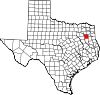 | |
| Towns | ||
| CDP | ||
|
Other unincorporated communities |
| |
| Ghost towns | ||
| Footnotes | ‡This populated place also has portions in an adjacent county or counties | |
 | This article about a location in Smith County, Texas is a stub. You can help Wikipedia by expanding it. |