Tazewell, Georgia | |
|---|---|
_Tazewell,_GA.JPG) The Old Marion County Courthouse is located in Tazewell. It was built in 1848 and added to the
National Register of Historic Places in 1980. | |
 Tazewell  Tazewell | |
| Coordinates: 32°22′50″N 84°26′27″W / 32.38056°N 84.44083°W | |
| Country | United States |
| State | Georgia |
| County | Marion |
| Area | |
| • Total | 1.59 sq mi (4.1 km2) |
| • Land | 1.59 sq mi (4.1 km2) |
| • Water | 0.01 sq mi (0.03 km2) |
| Elevation | 487 ft (148 m) |
| Population | |
| • Total | 93 |
| • Density | 58.6/sq mi (22.6/km2) |
| Time zone | UTC−6 ( Central (CST)) |
| • Summer ( DST) | UTC−5 (CDT) |
| ZIP Code | 31803 |
| FIPS code | 13-75692 |
| GNIS feature ID | 356586 |
Tazewell is an unincorporated community and census-designated place (CDP) in Marion County, in the U.S. state of Georgia. [3]
The 2020 census, listed a population of 93. [2]
History
A post office called Tazewell was established in 1837, and remained in operation until 1985. [4] The community was named after Henry Tazewell, a United States senator from Virginia, state legislator and judge. [5] Tazewell was named the county seat of Marion County in 1838. [6] The Old Marion County Courthouse still stands at Tazewell and was added to the National Register of Historic Places on September 18, 1980. [7]
A variant spelling was "Tazwell" (without the E). [3] The Georgia General Assembly incorporated the place as the "Town of Tazwell" in 1854. [8] Tazewell today is an unincorporated area. [3]
Geography
Tazewell is in eastern Marion County, in the valley of Shoal Creek. State Routes 137 and 24 cross in the center of town. SR 137 leads southwest 6 miles (10 km) to Buena Vista, the county seat, and northeast 18 miles (29 km) to Butler, while SR 240 leads east 26 miles (42 km) to Oglethorpe and north 18 miles (29 km) to Geneva.
According to the U.S. Census Bureau, the Tazewell CDP has a total area of 1.6 square miles (4.1 km2), of which 0.01 square miles (6.4 acres), or 0.50%, are water. [1] Shoal Creek and Gin Creek join at the southern edge of the community to form Buck Creek, which flows east to the Flint River at Oglethorpe.
Demographics
| Census | Pop. | Note | %± |
|---|---|---|---|
| 2020 | 93 | — | |
| U.S. Decennial Census
[9] 2020 [10] | |||
Tazewell was first listed as a census designated place in the 2020 U.S. Census. [10]
| Race / Ethnicity | Pop 2020 [10] | % 2020 |
|---|---|---|
| White alone (NH) | 87 | 93.55% |
| Black or African American alone (NH) | 0 | 0.00% |
| Native American or Alaska Native alone (NH) | 0 | 0.00% |
| Asian alone (NH) | 0 | 0.00% |
| Pacific Islander alone (NH) | 0 | 0.00% |
| Some Other Race alone (NH) | 0 | 0.00% |
| Mixed Race or Multi-Racial (NH) | 1 | 1.08% |
| Hispanic or Latino (any race) | 5 | 5.38% |
| Total | 93 | 100.00% |
References
- ^ a b "2022 U.S. Gazetteer Files: Georgia". United States Census Bureau. Retrieved January 23, 2023.
- ^ a b "P1. Race – Tazewell CDP, Georgia: 2020 DEC Redistricting Data (PL 94-171)". U.S. Census Bureau. Retrieved January 23, 2023.
- ^ a b c U.S. Geological Survey Geographic Names Information System: Tazewell
- ^ "Post Offices". Jim Forte Postal History. Retrieved 21 June 2019.
- ^ Krakow, Kenneth K. (1975). Georgia Place-Names: Their History and Origins (PDF). Macon, GA: Winship Press. p. 223. ISBN 0-915430-00-2.
- ^ "Marion County". GeorgiaInfo. Retrieved 21 June 2019.
- ^ "Marion County". nationalregisterofhistoricplaces.com. Retrieved 21 June 2019.
- ^ Acts and Resolutions of the General Assembly. 1854. pp. 272–.
- ^ "Decennial Census of Population and Housing by Decades". US Census Bureau.
- ^ a b c "P2 HISPANIC OR LATINO, AND NOT HISPANIC OR LATINO BY RACE – 2020: DEC Redistricting Data (PL 94-171) – Tazewell CDP, Georgia". United States Census Bureau.
Municipalities and communities of
Marion County, Georgia, United States | ||
|---|---|---|
| City | 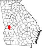 | |
| CDP | ||
|
Other unincorporated communities | ||
|
| This Marion County, Georgia state location article is a stub. You can help Wikipedia by expanding it. |