| Taylor Glacier | |
|---|---|
| Type | Mountain glacier |
| Location | Larimer County, Colorado, United States |
| Coordinates | 40°16′15″N 105°40′37″W / 40.27083°N 105.67694°W [1] |
| Terminus | Talus |
| Status | Retreating |
|
| |
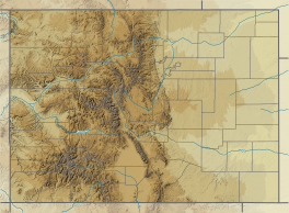
Taylor Glacier is a small cirque glacier in Rocky Mountain National Park in the U.S. state of Colorado. [2] Taylor Glacier is on the east side of the Continental Divide and adjacent to Taylor Peak. Taylor Glacier is both an ice and a rock glacier, with the lower portions of the glacier being composed primarily of rock debris and a small portion of ice. [3]
See also
References
- ^ "Taylor Glacier". Geographic Names Information System. United States Geological Survey, United States Department of the Interior. Retrieved August 19, 2012.
- ^ McHenrys Peak, CO (Map). TopoQwest (United States Geological Survey Maps). Retrieved August 19, 2012.
- ^ "Glacier Basics". Glaciers and Glacier Change of Rocky Mountain National Park. National Park Service. Retrieved August 19, 2012.

